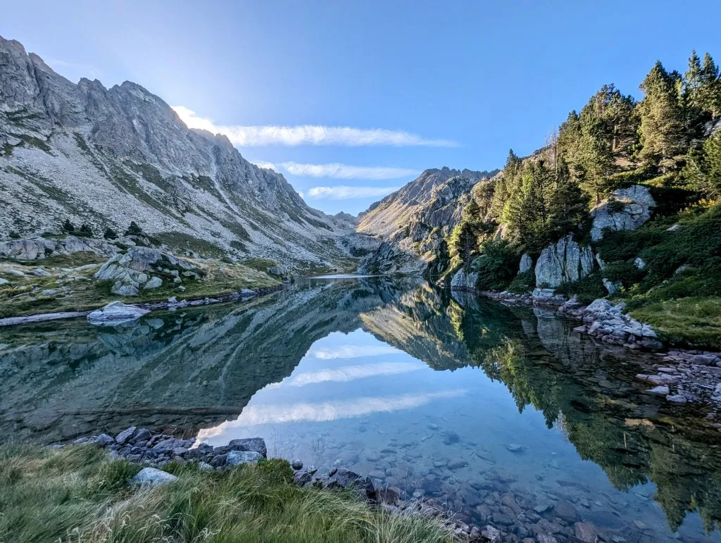
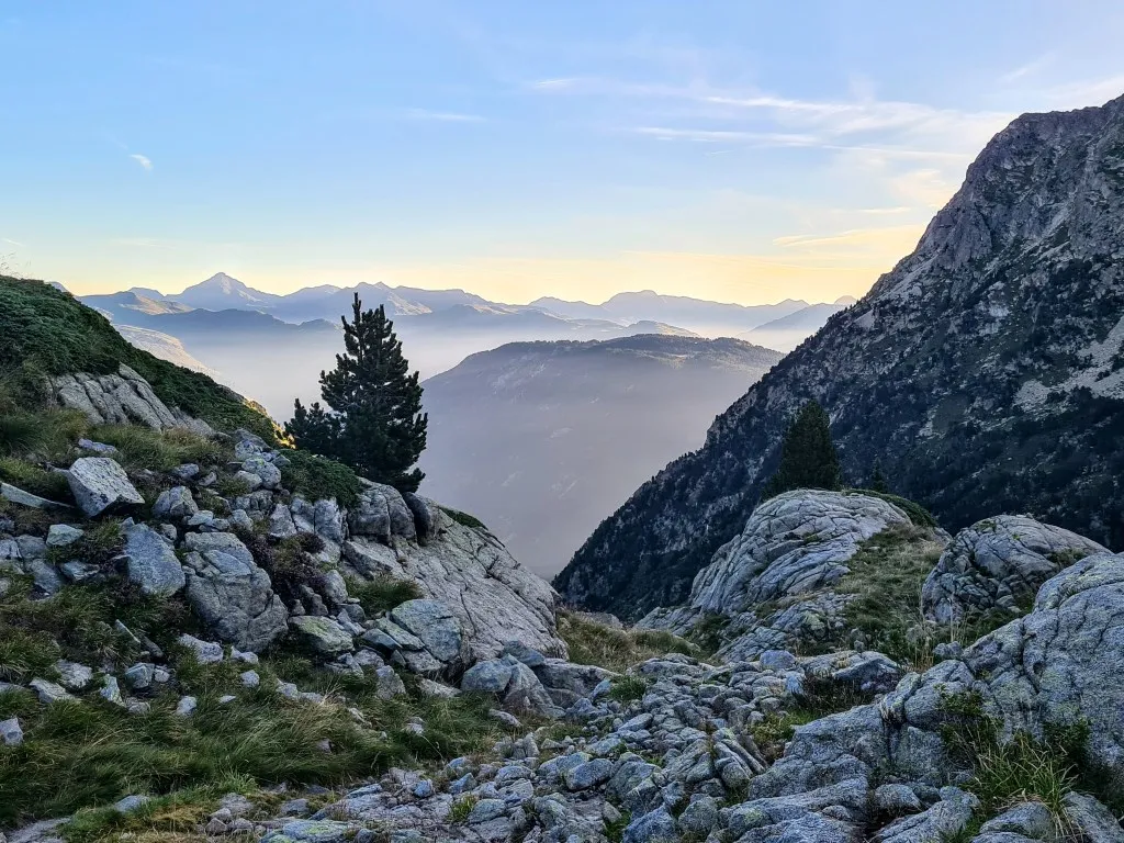
Unfortunately, it was cloudy last night, so we didn't see many stars. But the evening was calm, and the night was windless, so we wake up well-rested this morning, ready for another mountain stage. With our gear packed, the tent still damp from the dew, we hit the trail again. The first stretch along the beautiful Lake Lac de Mar has little elevation gain, although we never walk entirely flat. Up and down small hills along the lakeside, mostly on trails but sometimes over sections with rocks and loose stones. We apparently snagged one of the last spots for the tent; there's no suitable place for bivaking until the descent. Once past the lake, the descent to the next lake and Refuge Restanca begins, where we hope to refill our water supply. The descent goes through gorges and over steep slopes but isn't particularly difficult anywhere. At the beginning of the descent, the river coming from Lac de Mar is completely dry. The water is diverted through an underground pipe and emerges lower down the mountain with great force after generating electricity. We return to the altitude of pine trees and encounter a large flock of sheep; they are spread out on a large field next to and on the trail. We hear barking, but it seems to come from further away. We're not entirely at ease because bears inhabit this area; more than 70 were counted in the Pyrenees last year.
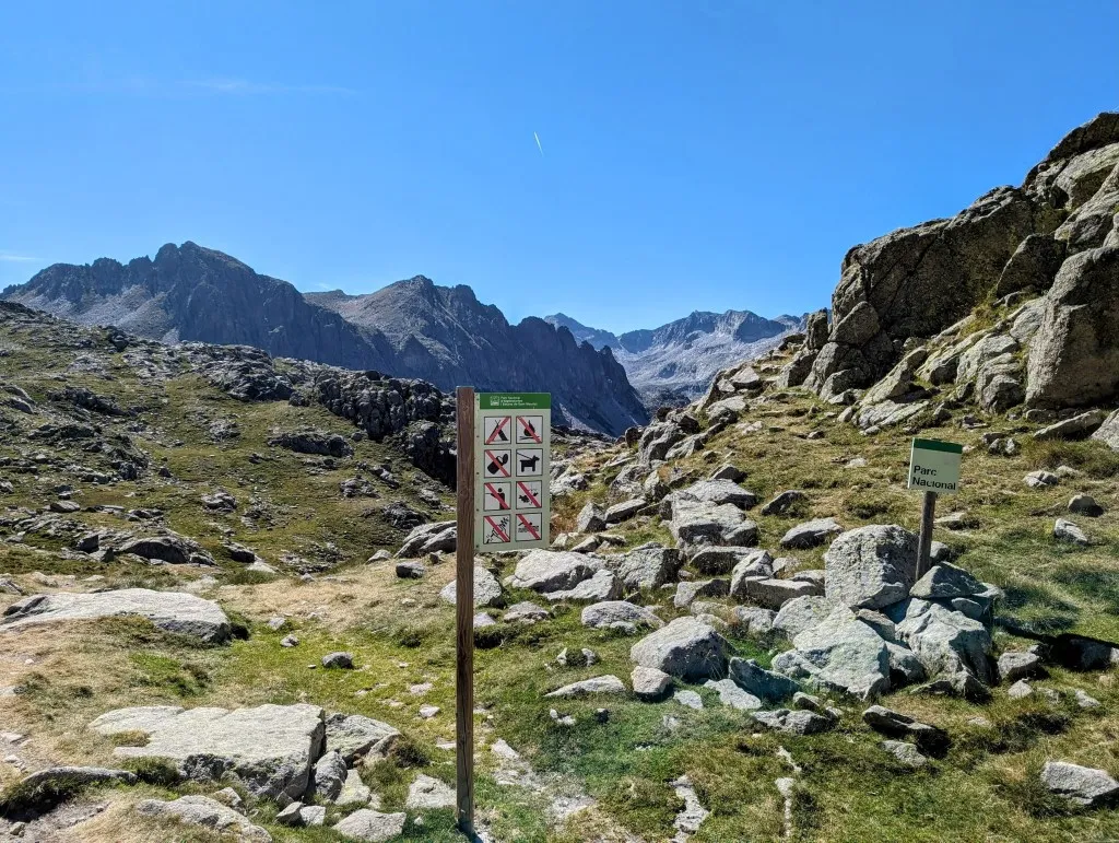
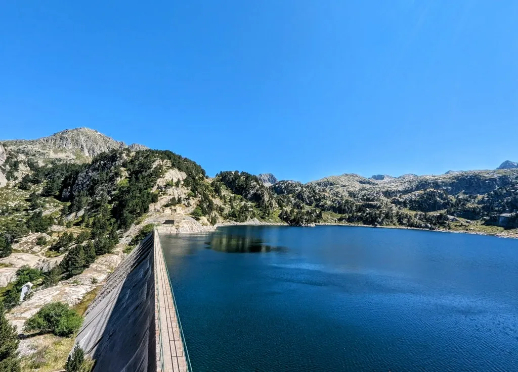
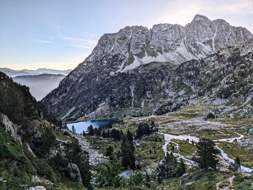
They eat roots, acorns, berries, fruits, and nuts, but occasionally also a sheep or goat. Hundreds of sheep are consumed by the bears, but most animals perish because they are driven off cliffs in panic. A sturdy watchdog is therefore advisable. But fortunately not here, so we can pass undisturbed. Just be careful not to scare them off the rocks ourselves because they are not the most attentive animals, and they often startle only at the last moment as we approach. A bit more descending, and we arrive 250 meters lower at the refuge next to the lake. This lake is a reservoir, built to generate electricity from the same water once again. But natural or not, it's magnificent, and the refuge is beautifully situated. And busy. It was full last night. We left this morning at 7:00 a.m. to beat the heat a bit, arriving at the refuge shortly after 8 o'clock, and one group after another is getting ready to leave or has already left, heading in the same direction as us, towards Aigüestortes National Park. And rightfully so, it's a stunning, unique, ancient national park, protected since 1955, with 9 rivers and 80 lakes in an area one and a half times the size of Paris. It features high peaks and low forested valleys where humans have left their mark through deforestation, livestock farming, tourism, and the construction of reservoirs, but never permanently inhabited. A remarkable piece of nature. After filling some bottles with drinking water, we follow the mainly Dutch, German, and Belgian families up the mountain.
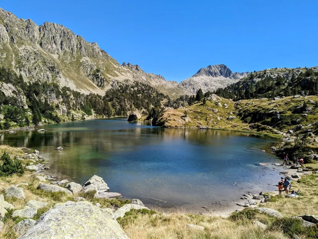
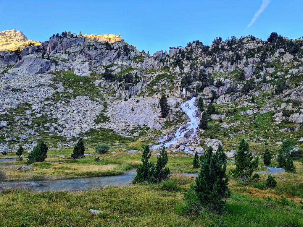
A climb of 230 meters brings us to a new small lake where, after quickly having a cup of coffee and a banana this morning, we enjoy an extensive breakfast. The lake is named Lac deth Cap deth Pòrt, a typical name from the Aran Valley in Aranese. Climbing higher again and another 250 meters later, we reach the border of the national park at Port de Oelhacrestada, and a bit further, just above 2,500 meters, we cross a pass to descend steeply to Lake Estany del Port de Caldes, only to climb again on the other side of the valley to a pass just below Tuc deth Cap Pòrt de Caldes (what names…). The landscape is stunning, with one lake after another, green meadows, and occasionally we encounter some cows.
Because the park is so large and expansive, it's quieter a bit further from the access paths than near the refuge, but we're certainly not alone. We encounter many hikers, and at the lakes and cols, groups of people catch their breath. We move fairly quickly along the trails, which we haven't had in a while, but our story travels faster… We encounter some hikers on a climb who ask if we're the ones who started all the way in Portugal!? It's in Spanish, French, and English, and at first, we don't understand, but then it clicks. Ah, yes, um, indeed, that's us. They think it's fantastic! They're hiking to the Atlantic coast and will talk about us more. Since we've been on the HRP, we've had many enjoyable encounters. Further along, we will be following the GR11 again, curious to see if it stays that way.
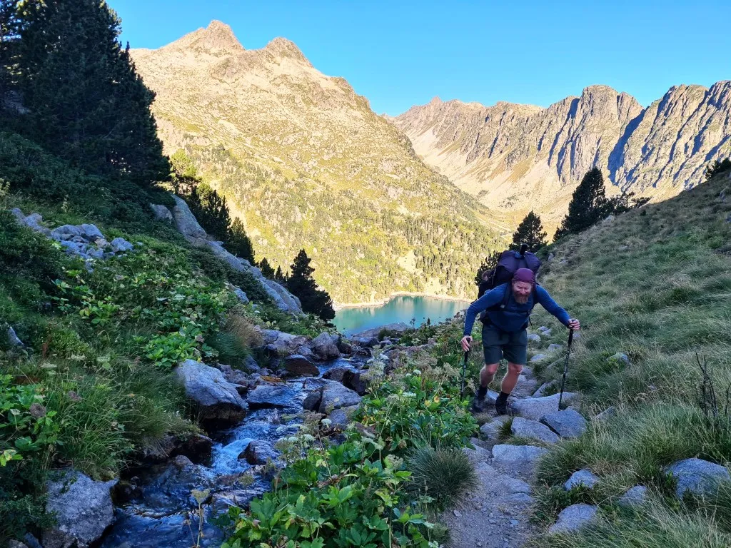
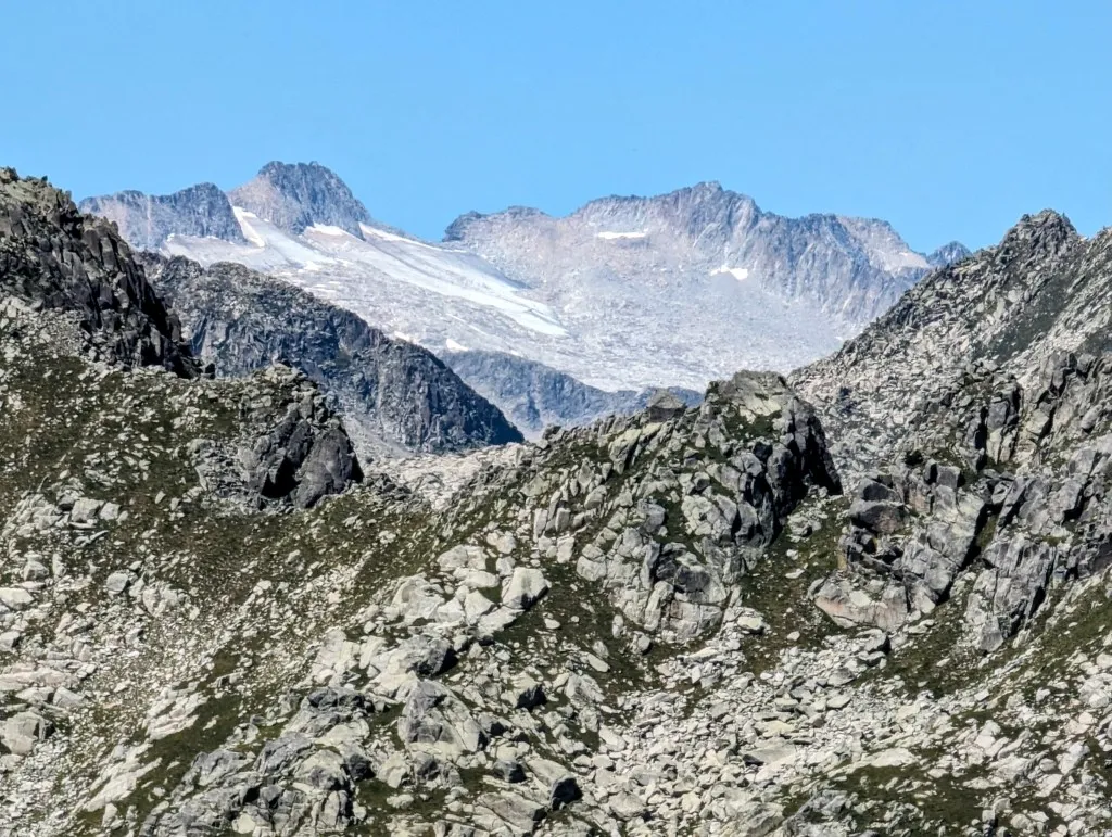
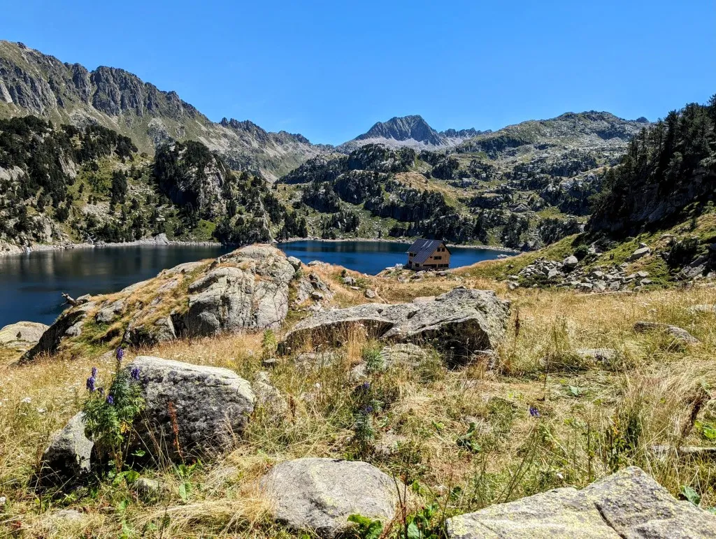
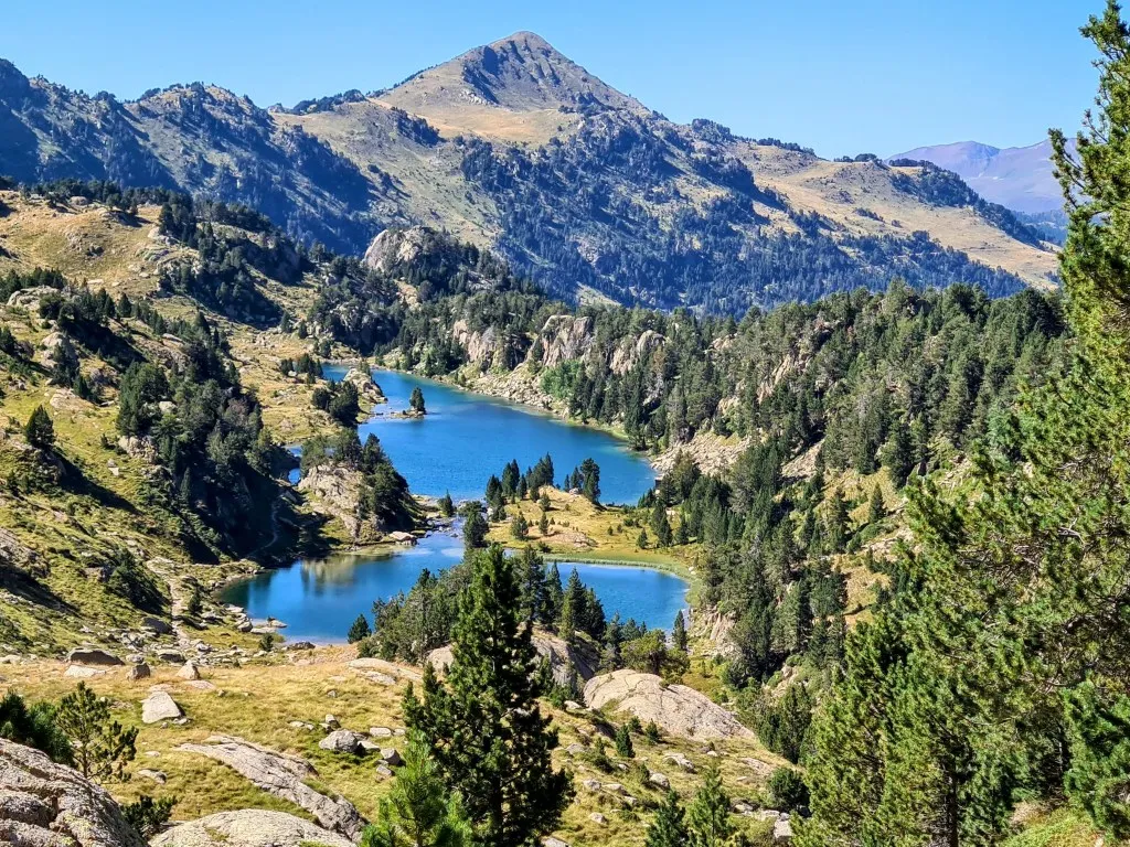
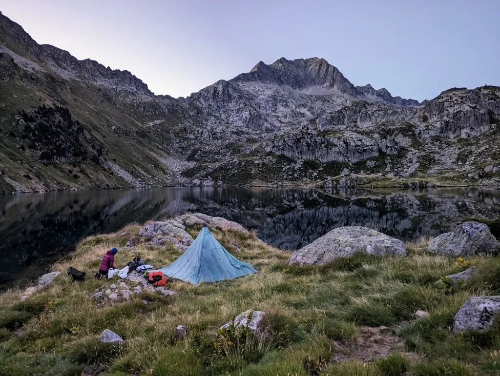
Looking back, we see in the distance the glaciers and the highest peaks of Pico Aneto. It seems so long ago now, but it's so close. Before us lies a new valley. A long descent from 2,550 to 2,120 meters at Lac Major de Colomèrs with the refuge of the same name. This valley is outside the park again, but it's certainly no less beautiful. After the initial steep descent, we follow a river through a narrow valley. It's a fast-flowing river, and because it's often marshy, we see different beautiful plants and animals: cotton grass, the small blue gentian, and many frogs. The descent is pleasant, but the kilometers here in the mountains count double. After 10 kilometers, we reach the refuge at the edge of the large lake. It's wonderful to give our legs a rest and it's a nice place to meet fellow hikers again. Jean-Marc from the Cévennes has arrived here as well. Dyneema tents, backpacks, hiking apps, and the upcoming stage, there's always something to chat about when you're doing the same thing in your own way. This lake is a reservoir, at least a lake enlarged by a dam. We cross the dam and climb two more lakes higher. A little higher lies Lac Long and slightly higher still is Lac Redon, just before we re-enter the national park. Not as many altitude meters, but three stunning kilometers along a beautiful path beside the water, pine trees, grass, flowers, and blueberries amidst the stunning barren, rocky mountains. At the lake, we veer off the path onto a peninsula. There, not far from the water, is a nice flat spot, with a magnificent view of tomorrow's climb, far across the lake. It's still early when we end the stage, just before half-past four, but continuing doesn't make sense. In Aigüestortes, bivaking is not allowed, and we'd rather not risk a fine of 400 euros per person. So, we take it easy, rest a bit, and enjoy the scenery. As evening falls, we're completely alone in the valley, it's just us and the mountains. And tonight, it's clear, and we actually see a few shooting stars! What a beautiful world… It exists, really!