August 10th
Kilometer 2.479,5
This morning, we take the bus through the Vielha tunnel to the endpoint of the previous stage and the beginning of yet another journey. A remarkable tunnel from a remarkable area. For a long time, the tunnel at over 5 kilometers long, was the longest tunnel in the world, and also due to lacking safety measures for a long time, the most dangerous in Europe. The tunnel was completed in 1941, but its opening didn’t occur until 1948, forcing Jews fleeing from occupied areas to embark on a harrowing journey through passes and mountains in Spain, only to often be apprehended on the other side and placed in camps.
Valle d’Aran, where Vielha is located, is a distinct region within Catalonia, through which we hike after descending from Tuc Molières. Catalonia is an autonomous community within Spain, and Vallé d’Aran has advanced autonomy within it, with its own language, customs, and festivals. This is because this valley is the only part of the Pyrenees in Catalonia that lies to the north of the highest peaks and, until the tunnel was built, was only accessible via mountain passes at 2,450 meters high. For much of the year, it was cut off from the rest of the country, although contact with France was possible for longer periods because the mountains on that side are lower. The language of the valley, Aranese, is used as a first language by a majority. It’s been interesting to experience this for a few days.
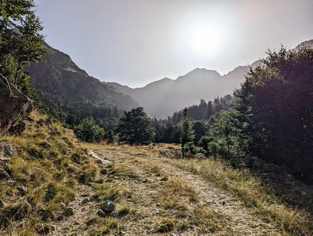
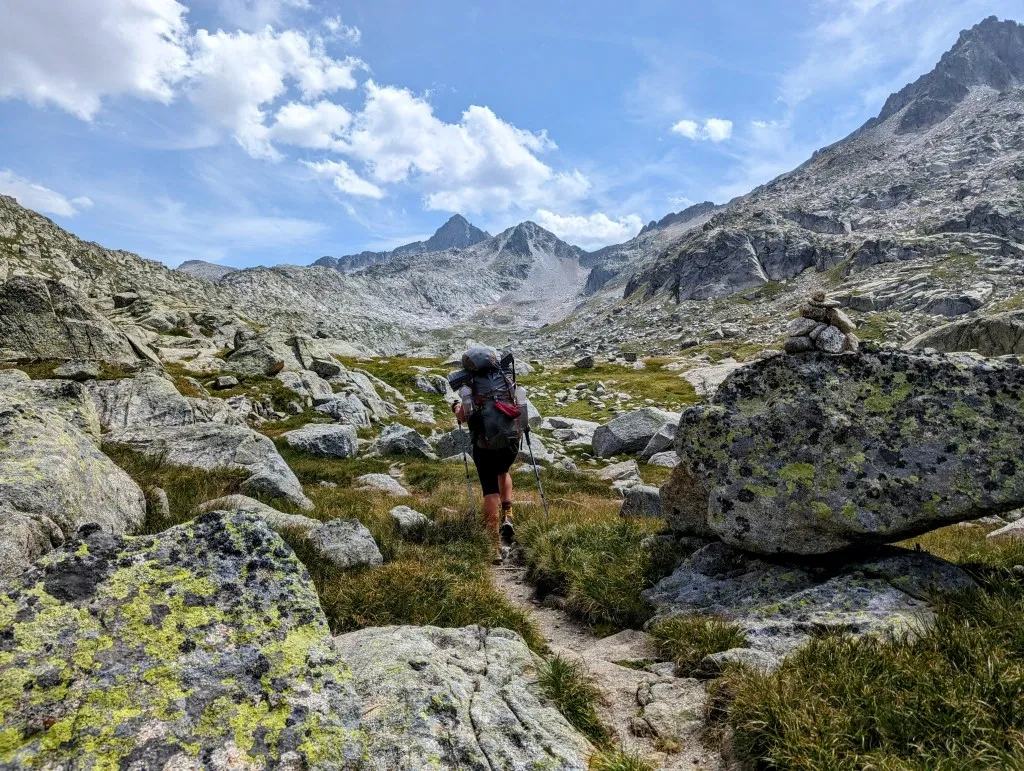
Fully equiped with new hiking poles—the previous four didn’t survive the last few journeys—and hiking boots (apparently, one pair couldn’t handle the rocky high mountains), we’re ready once again. It’s delightful to head back into the mountains. Ahead of us lies a stunning stretch of almost 45 kilometers along and through the Aigüestortes i Estany de Sant Maurici National Park. A granite massif with numerous lakes carved out by glaciers. It might be doable in two stages, but given the significant elevation gain, we’re prepared for three. The temperature, which surpasses 30 degrees Celsius in the valleys, will also pose a challenge. And it’s immediately noticeable as we step off the bus at the parking lot near Refuge Conangles. It’s just after 9 o’clock, but already quite warm.
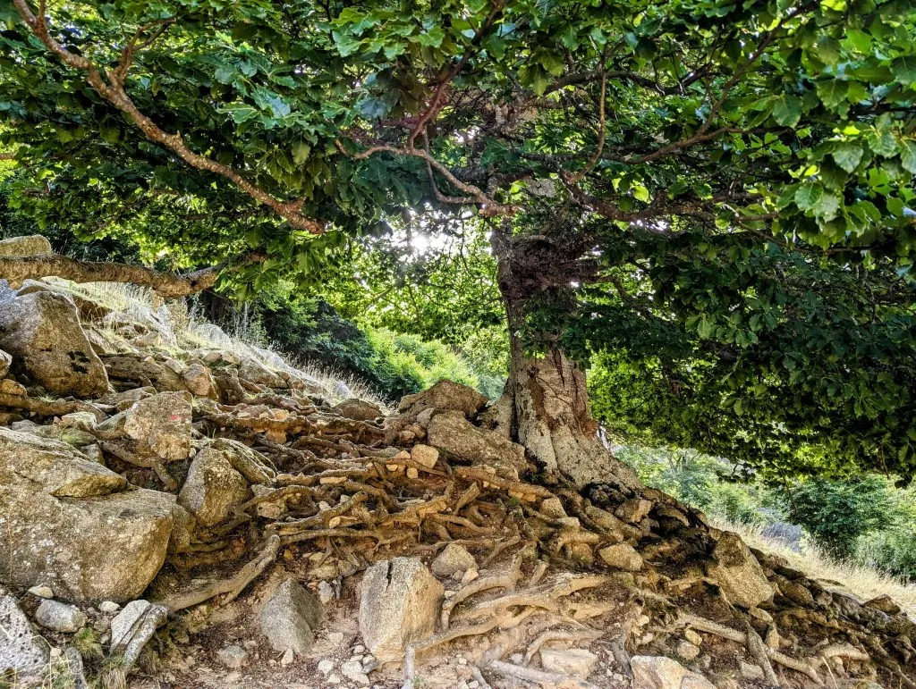
We walk back along the wide road toward the tunnel and then hit the trails. Right away, we begin a climb of almost 800 meters up the slope where the tunnel passes through, following the Vall de Conangles towards Lac de Rius, a large lake at 2,330 meters. At the start, we occasionally find shade from an old beech or pine tree, or some relief from a cold stream, but soon the trail steepens, and we rise above the tree line. With fresh legs, we ascend quick, but so does the temperature. We try to keep walking steadily, stay in motion, just keep climbing.
Only when we’re far above enough, we take a moment to have a drink and eat a nut bar to refuel our energy. A hiker we’ve passed a few times during the climb walks by, a young man from Vitoria, a larger Basque city we’ve also passed through. We strike up a conversation about his route, our route, the Spanish and Basque culture, customs, and language. He’s amazed that we’ve crossed the entire Iberian Peninsula on foot; it’s a dream for many Spaniards. In moments like these, we realize that many steps make many stages, and many stages create something special: a journey through the present and past of a unique piece of Europe. He continues on his way, and shortly after, so do we, for one last climb to the lake.
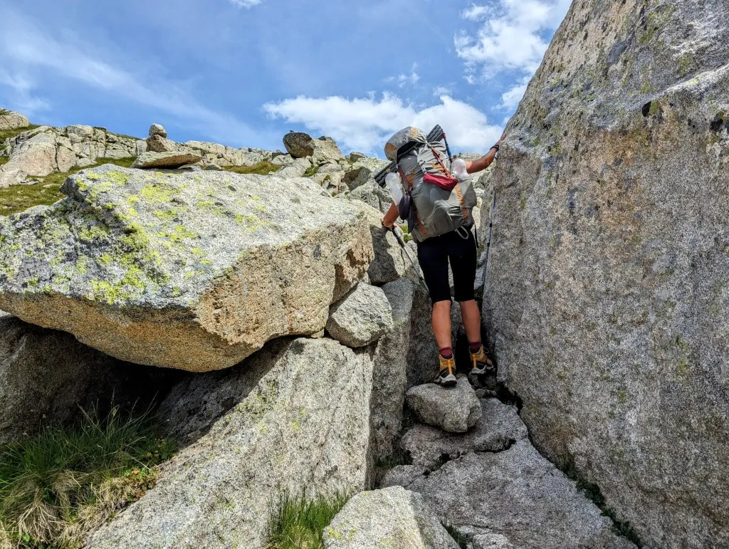
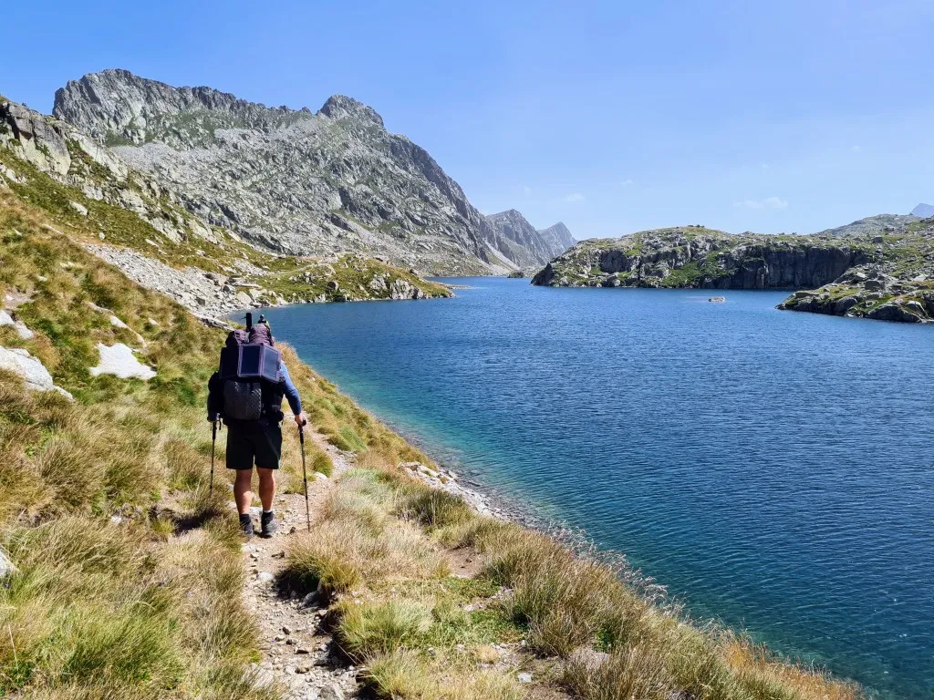
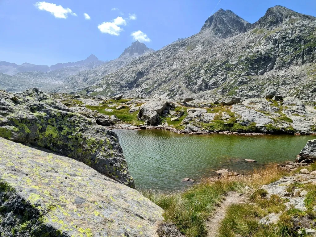
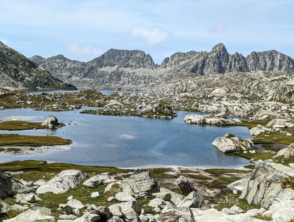
First, we pass by a small lake nestled among rocks, and then we have a view of Lac de Rius, Catalan for the Lake of Rivers. It’s the first of many lakes in this wilderness area of Aigüestortes. The lake is surrounded by peaks well above 2,500 meters, granite thrust upwards because the Iberian Plate has been pressing against the European Plate. 450 million years ago for the first time, but more recently over the past 50 million years. The valleys this high in the mountains have been carved by glaciers, and the granite forms an impervious layer, where, in these warmer times, water collects, forming lakes. We walk around the beautiful lake, cross the beginning of the Rius River, and arrive at a fork in the paths. The HRP and the GR11 turn left, but we’ve seen a trail on the map that goes past several more lakes, through a valley with a climb and descent to the next valley, before rejoining the routes at Refuge de la Restanca on the shore of Lake Era Restanca. On the map, that route looks more scenic than the other one that stays along a slope. It’s a few kilometers longer and involves quite a few extra meters of elevation gain, but of course, we decide to take it and soon find ourselves walking past large granite boulders on grasslands and between small and large lakes.
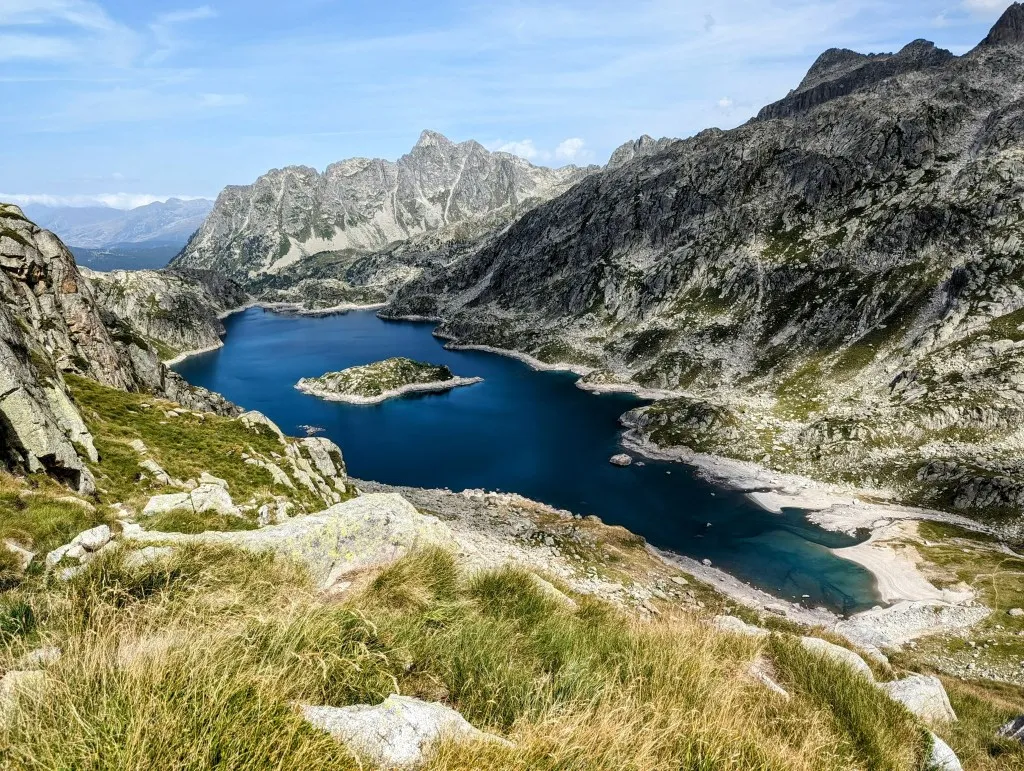
It looks flat on the map; contour lines are marked every 10 meters. But we’re constantly either ascending or descending. The landscape is stunning, with mountains, lakes, rocks, and grass, a paradise high in the mountains! At the edge of another lake, Lac Tòrt d’Arrius, we pause. A long break after many meters of elevation gain. Across the lake, we see the climb that awaits us. Only because there are people walking across it do we see how high it is; otherwise, it would be almost impossible to estimate. It’s delightful to cool ourselves off with our feet in the water and take a breather. Just as we’re about to continue, another hiker passes by with an interesting story. He’s from the vicinity of Anduze in the Cévennes and is hiking the Hexatrek. Our route will pass the Cévennes between Andorra and Nice, so we get some good tips about that part of the route. Meanwhile, time flies, but the kilometers stand still. It’s almost 3 p.m. when we continue, so we’ve given up on the idea of splitting the route in two; we don’t want to hike until 7 p.m. or even later through the mountains if we don’t have to. We continue along the lake and through its marshy beginning. We see many tadpoles, dragonflies, and aquatic plants. We begin the climb. The path is occasionally hard to find, but it’s not very steep. At the top of the pass, Grinches de Rius, we have a magnificent view over the lakes behind us and the deep valley ahead of us with Lac de Mar in Circ de Restanca. ‘The sea lake,’ with a beautiful white beach on its southern side and an island in the middle. The lake is 83 meters deep, giving the water a deep blue color. The valley is a sight to behold! We take a short break to drink some water, eat an apple, and then start descending. However the uphill slope was mild, the descent on the other side is of an entirely different caliber. Steep with many loose stones. It’s not long, but it’s deep. In about 750 meters, we descend almost 250 meters. It’s quite intense and time-consuming. We need to be careful, especially later in the day, as accidents can happen easily. During a deeper step down, Malou tumbles over Mark due to a slipping stone. It happened so slowly that it was funny, but it does sharpen our focus. We take it easy and manage well thereafter. At the bottom, we fill our bottles at a spring for the evening. It’s already past 5:30 p.m. It has been long enough for today so we start to look for a spot for the night. By the beach is a stunning flat spot, but there are too many mosquitoes there, so we choose a spot a bit further away. It’s flat, sheltered by rocks and an old glacial moraine. The spot is a bit close to the trail, so a few hikers pass by in the evening, including Jean-Marc from the Cévennes. But since we always wait until sunset to pitch the tent, it’s not a problem for us.
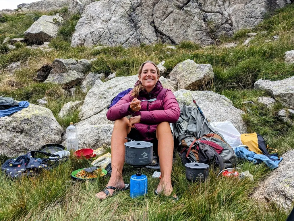
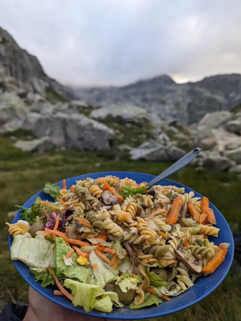
What a splendid journey today, where time flew faster than the kilometers. It’s nice to encounter so many talkative hikers and hear their stories, all in this incredibly beautiful area. We have a peaceful evening and enjoy our dinner. In August, the earth passes through a cloud of debris, resulting in many shooting stars, so if it’s clear tonight, we might get lucky. Plenty of wishes to make…