Superb stage along the massif of Mont Blanc. The day begins with a solid climb of 1100 meters to Col du Bonhomme at 2329 meters. The route then hikes over ridges and colls with magnificent views towards Mont Blanc. The route crosses a major road at Plan de la Laie. Here are restaurants and drinking water is available. Then it is still a long climb to the bivouac site with views over the peaks.
After spending several days at the campsite, with stormy weather that regularly left us with a wet suit, a broken tent pole, wet gear and a few inches of water in the awning, we are glad to get back out there with our backpacks on.
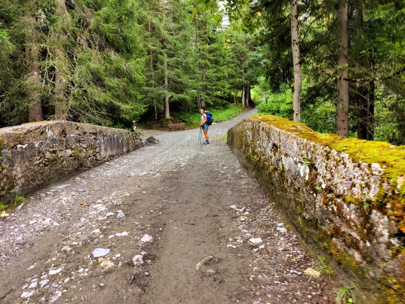
It's still cold and the tent is quite wet, but the sky looks nice and clear for the first time in days and we set out early. Along with dozens of other hikers in the field, we pack our gear and begin our trek. We follow the river that flows past the campsite uphill. When we arrived here, it was just a small river. By now it's increased significantly in size.
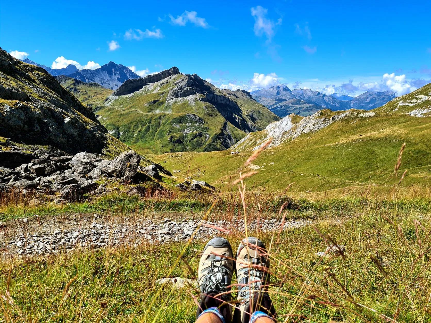
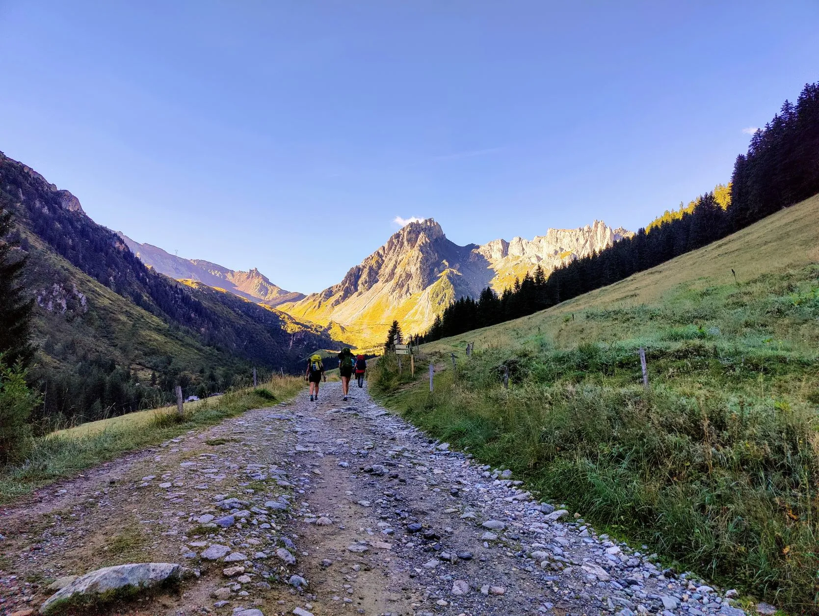
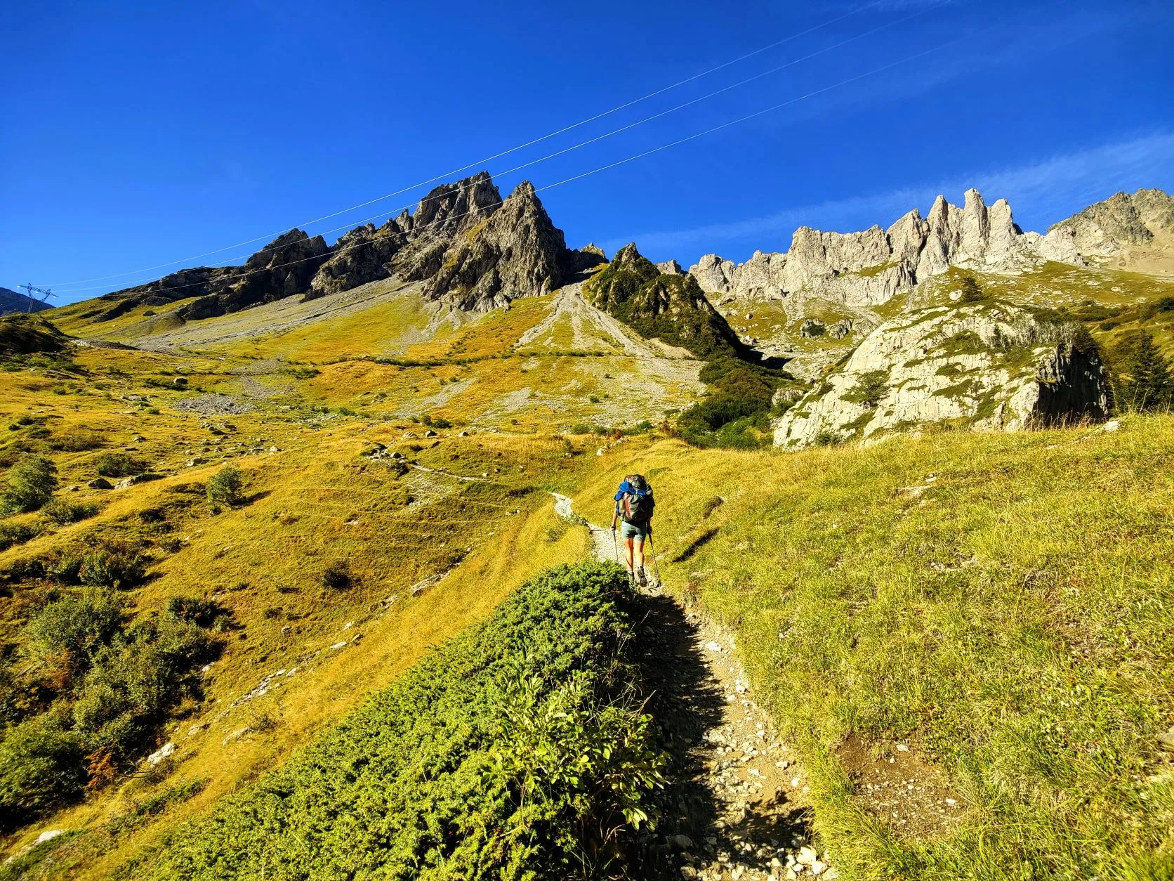
We walk up on the wide trails, at first past meadows and through forests, but as the trail gets steeper and we get higher, more and more through a mountain landscape. We walk into a high valley with wide views of the mountains around us. When we loook behind us we notice that we've already climbed quite a bit. Through this valley the trail goes on a long wide path that remains fairly flat. We walk between people with large backpacks in front and behind us, it's clear that we're still on the route of Tour de Mont Blanc... This route is followed by the vast majority of people here.
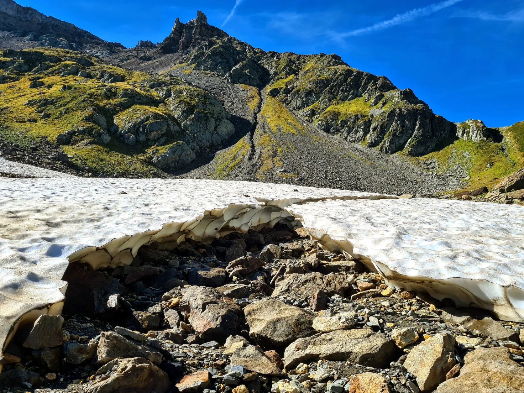
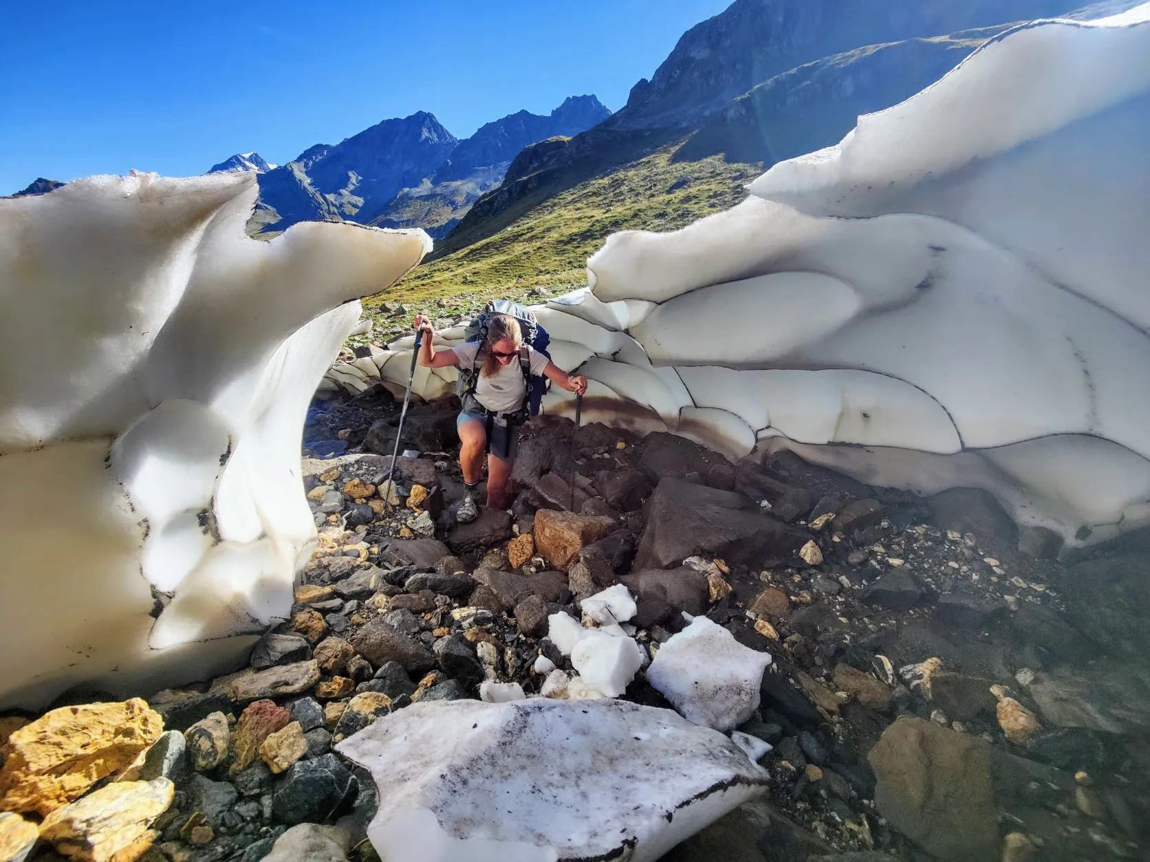
Up to Refuge de la Balme it remains fairly flat, where after the main path ends and we walk up steeply between the rocks, on small zigzag paths. We climb and we climb, the views becoming more and more spectacular. Just before the top is a plain where the sun apparently does not shine much: there's still quite large patch of snow that is broken in half, leaving a nice path to walk through. Wonderful to see these elegant round shapes of the halfmelted ice, floing among the jagged shapes of the rocks, trying to hold out until the end of summer. From here it's just a short walk to the Col du Bonhomme at 2329 meters. Together with fellow hikers, we enjoy the view: the valley where we started this morning behind us. In front of us a new valley with new mountain points and the area to which we are heading. We recover for a while, but the climb actually went pretty easy and fast. We climbed through the first 11.5 kilometers with 1,350 altimeters in 3 hours. That went well!
Here on top of the col the wind is fierce, so we walk a short distance to a lee place where we can take a break. From here the trail stays high for a while, then descends a bit and climbs again to 2,515 meters at Refuge de la Croix du
Bonhomme. It's clear that the GR5 turns away from the Tour de Mont Blanc here: at the refuge on the left it's quite crowded, but we turn right where hardly anyone is to be seen. From here we have the trail almost to ourselves again!
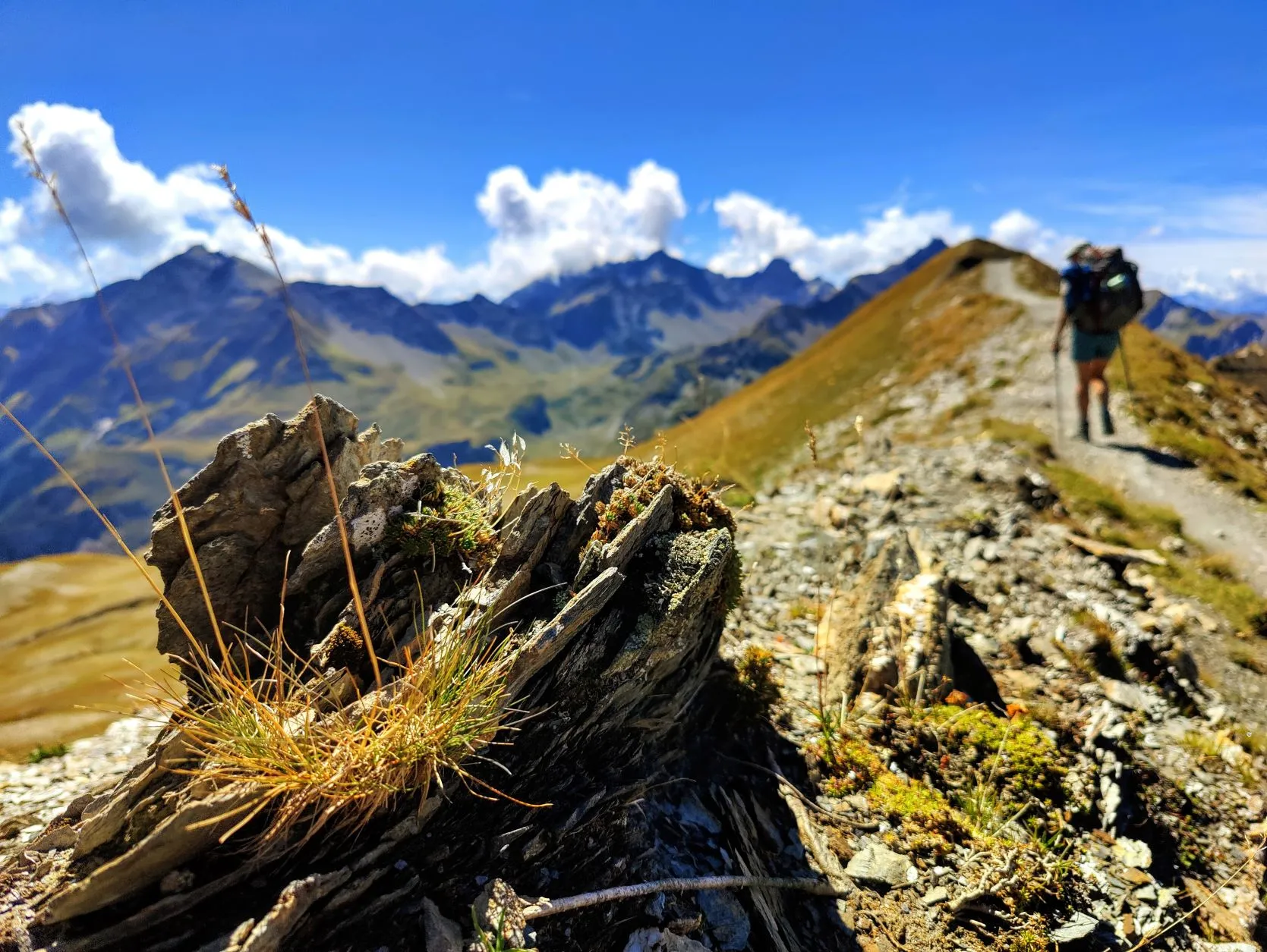
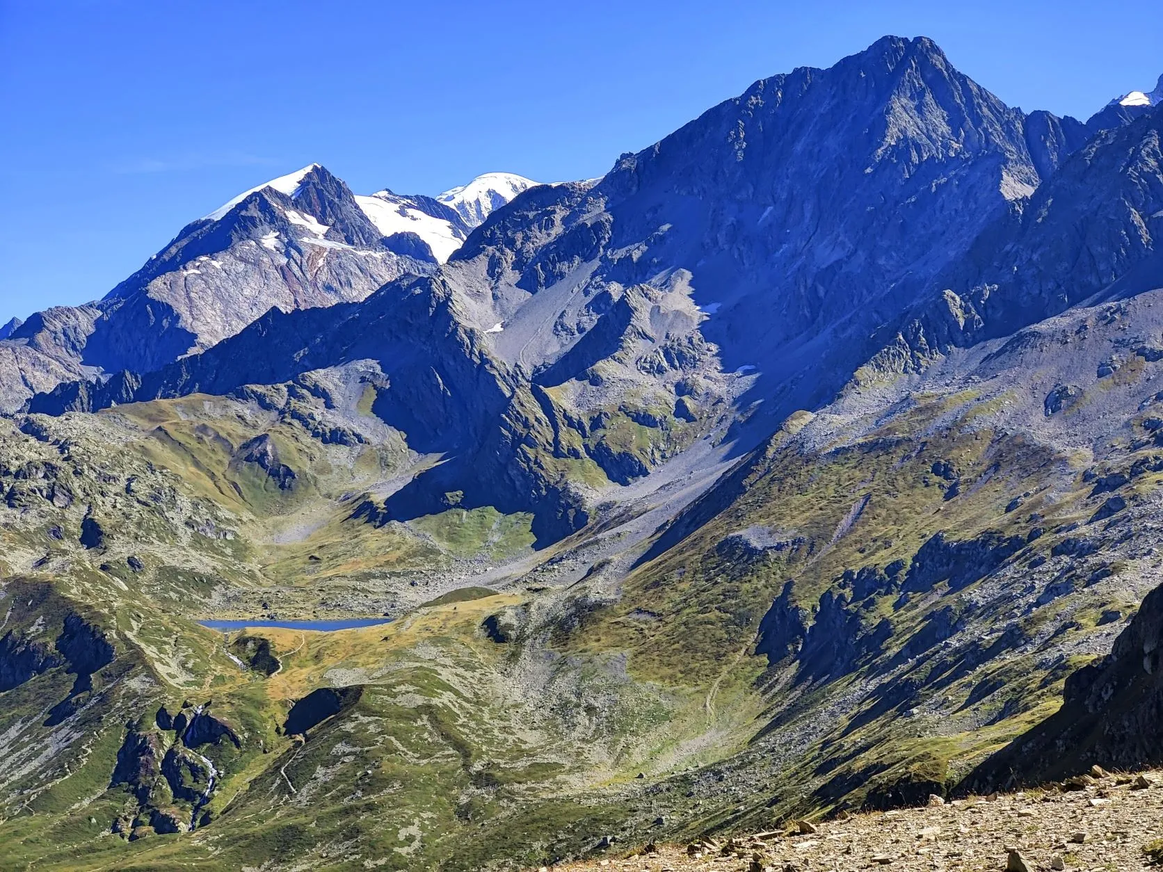
We descend a short distance and then arrive at a beautiful part of the route, Crête des Gittes. A slate ridge, with beautiful white fault lines of quartz through it, with deep chasms on either side. Overgrown with small grasses, mosses and flowers, and again stunning views all around us. At one point we look back and see once again the magnificent Mont Blanc towering head and shoulders above all the other peaks. It remains a unique picture...
A steep descent follows over the smooth slate rocks. Due to the wet weather of the past few days, it is quite slippery so we need to be careful. At the bottom, the path becomes more hiker-friendly again and we walk on a somewhat wider path between meadows where cows are grazing. By now the sun is high and it has warmed up well, so we pick a spot where we can set up our soaking wet tent to dry.
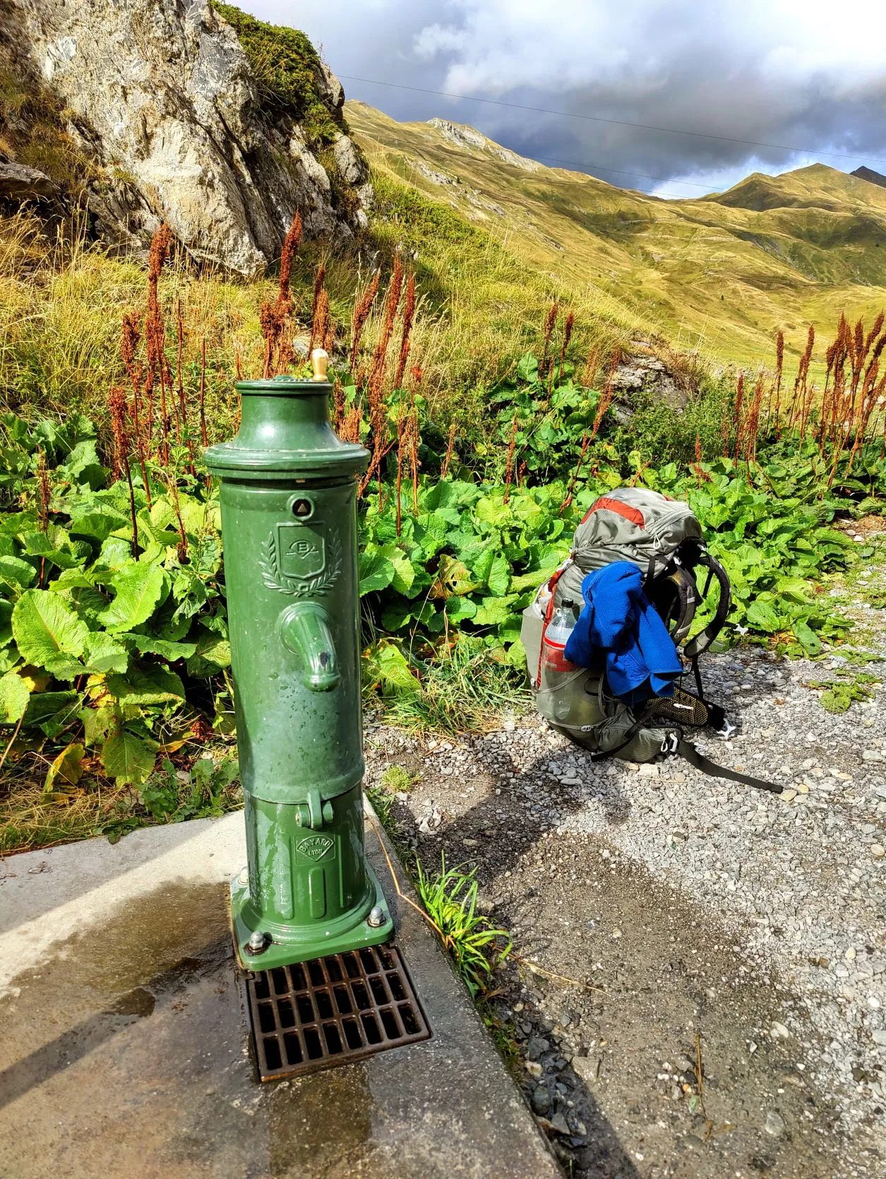
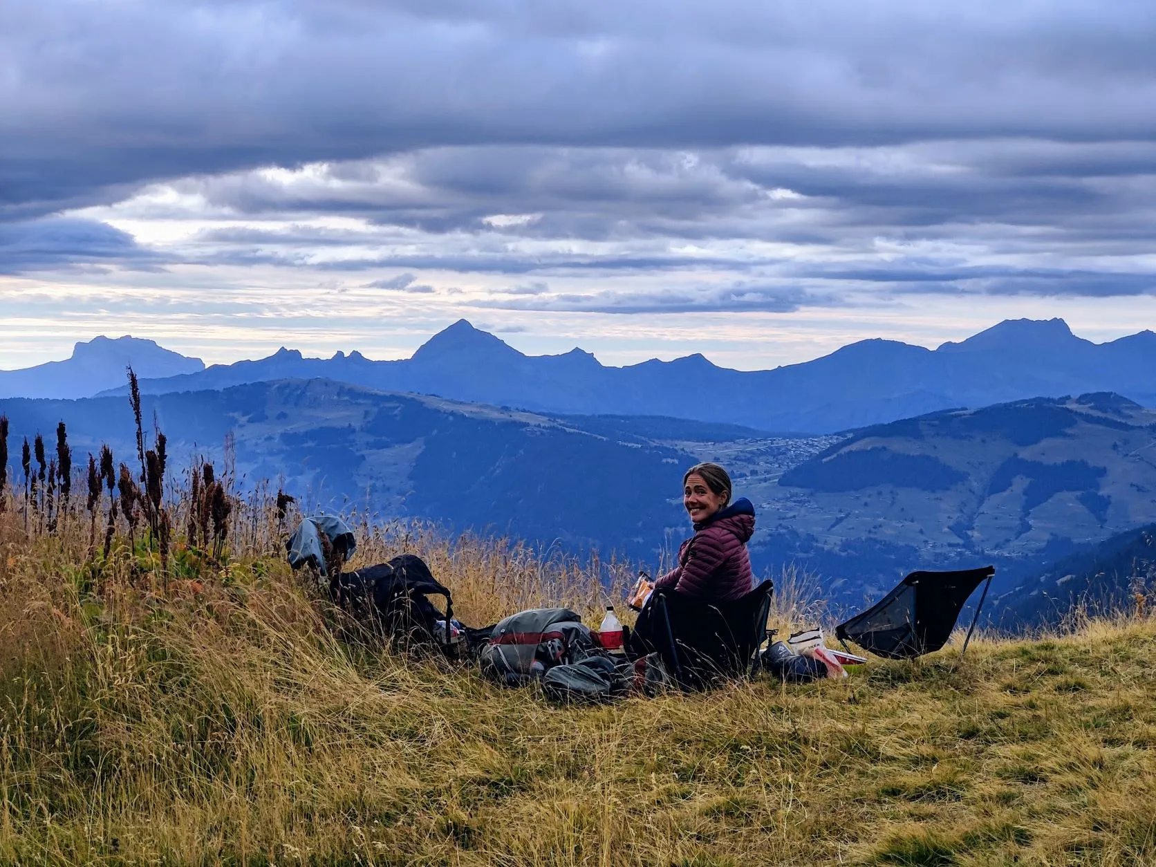
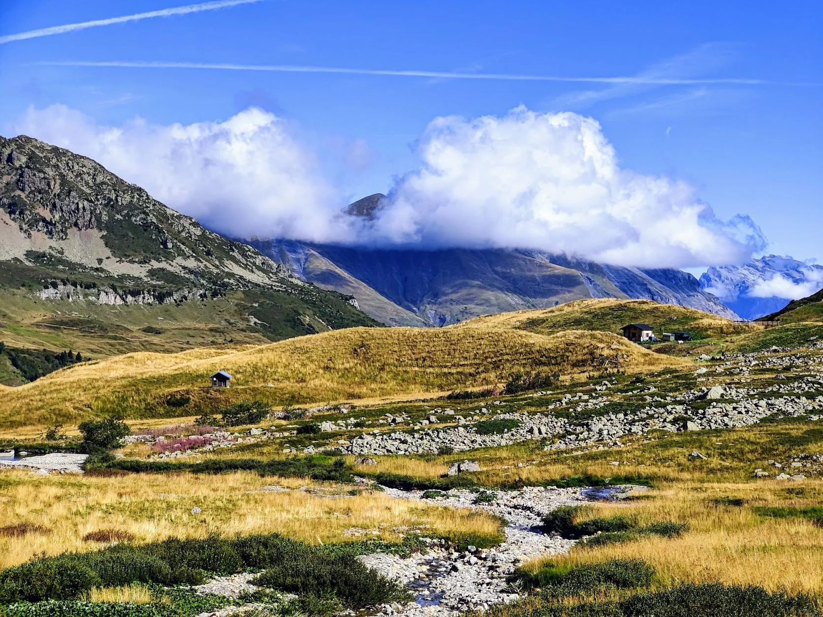
Two hours after dropping off our backpacks, our shoes are tied again and we continue on our way. That was a rare long break! It's still a fair bit of descent to Plan de la Laie at 1,822 meters. A small settlement with cottages and a large parking lot from which several hiking routes depart. We cross a road that we drove by car about 4 years ago, during a summer vacation. Funny to realize that we drove home in 2 days from here. At this spot there's also a tap with drinking water (convenient!) where we can fill our bottles, which we will need tonight. We'll walk to the other side of the valley, a bit more into the mountains and will then look for a good bivouac spot. This will be about halfway between Les Contamines and Landry, a stretch of 46 kilometers. After another hour of walking, between two hills, we see a perfectly flat piece of land, which seems to be used more often for bivouacs. We would have liked to continue walking, but this is too beautiful to pass up. And cow-free!
With yet another magnificent view, we begin preparing our meal: a bag of typical french (9 legumes) vegetable soup, a double bag of freeze-dried rice with goulash (which is surprisingly pretty delicious!), a salad and a vegetarian quinoa burger. What a luxurious meal so high up in the mountains!
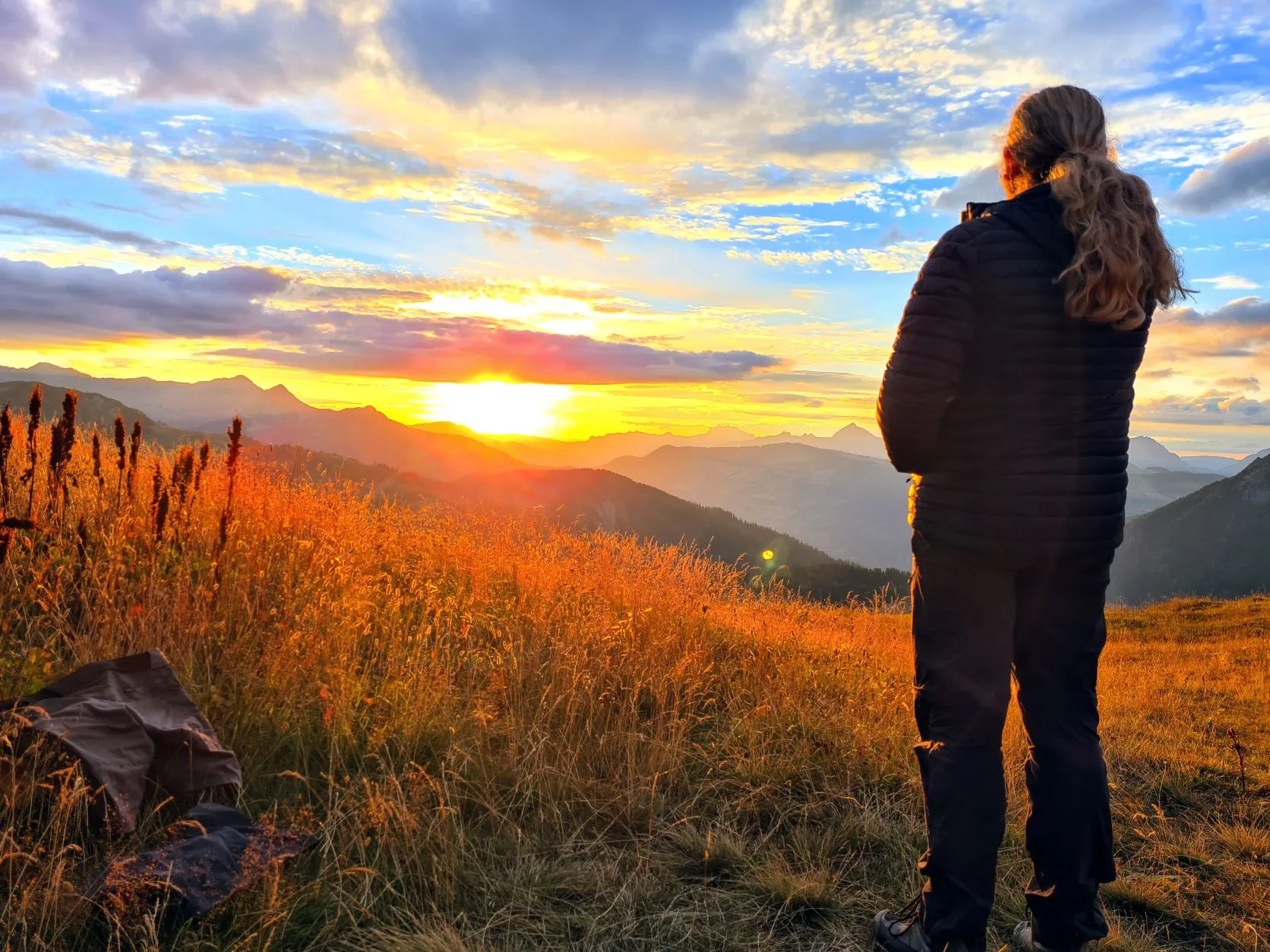
After dinner, the sun'll be setting in no time... No doubt this is going to be a lovely quiet spot for the night...