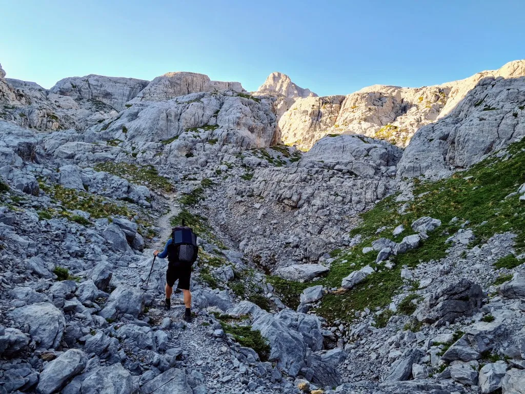
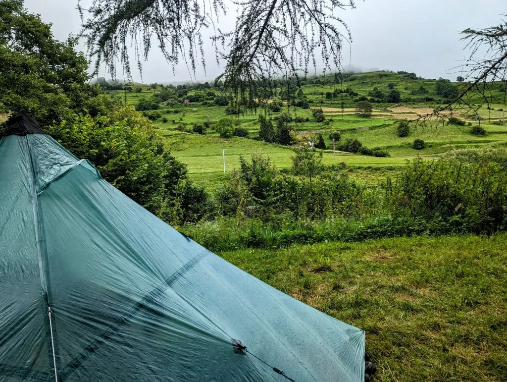
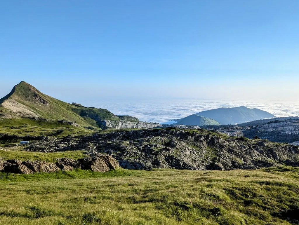
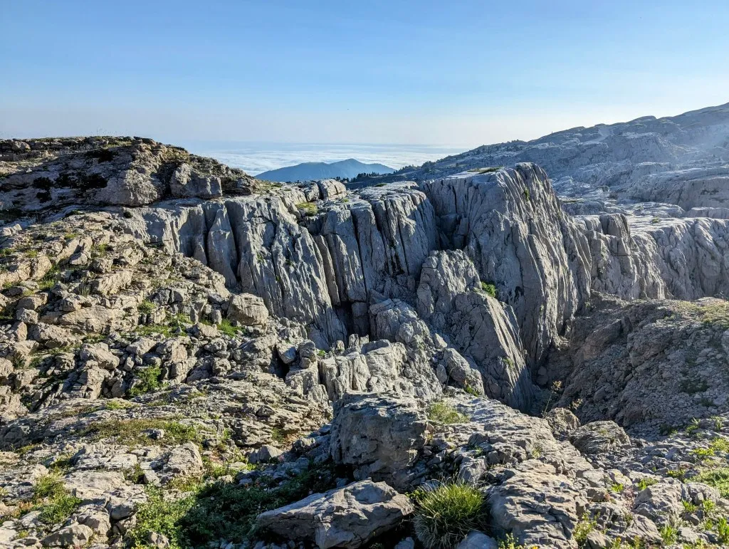
What a place to wake up in! We unzip the tent, look around, and immediately see the iconic Pic d’Anie. Climbing the small hill next to our tent, we see the valley below us shrouded in clouds, albeit less so than last evening. Mountain ridges and peaks emerge from the mist like islands in a sea. The sun has not yet risen, but it won’t be long before the orange glow paints the barren gray mountains we are heading towards this morning with an orange hue. It’s windy; even last night we had a few tense moments when gusts tried to seize our tent between the mountain winds. But fortunately, it held firm and stood as solid as a house. We’re up early today, already trekking over the first pass towards Anie, Col de Boticotch at 1.953 meters, just a bit higher than where we slept. The first part is still over grassland, but the terrain and the path quickly become rockier. At first, we walk over sections of rock, interspersed with patches of path. Here, the path is still easy to find, but as soon as it becomes a vast rocky plateau, it is only visible where small gravel reveals frequent foot traffic. Occasionally, piles of stones mark the route, but it requires careful searching. We step from stone to stone, often weaving through giant boulders and rock walls, over deep holes, and past caves.
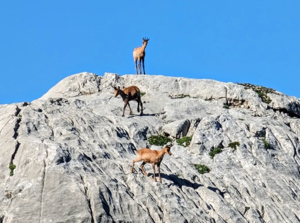
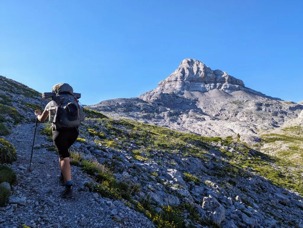
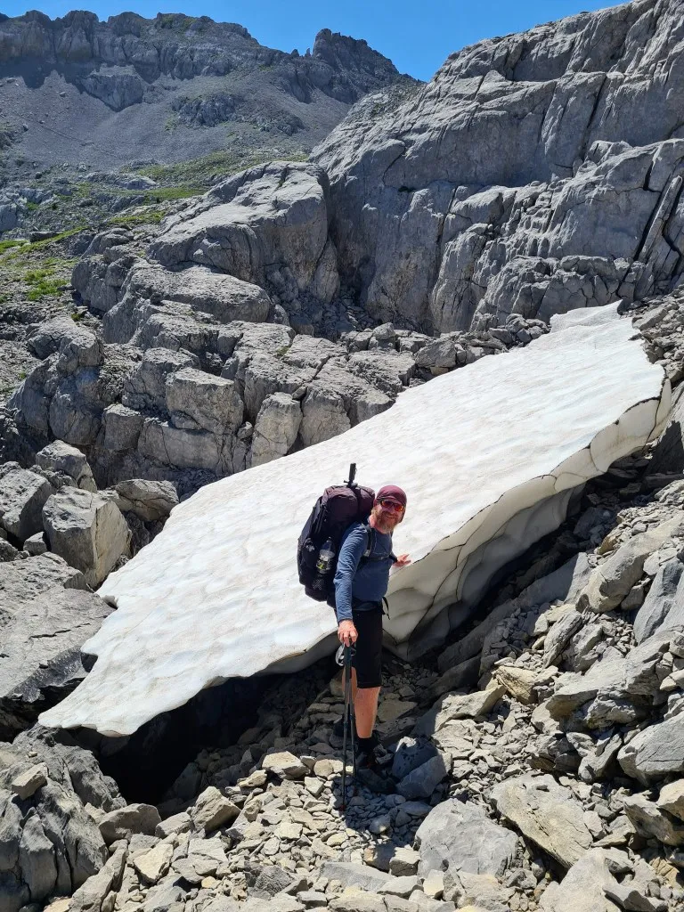
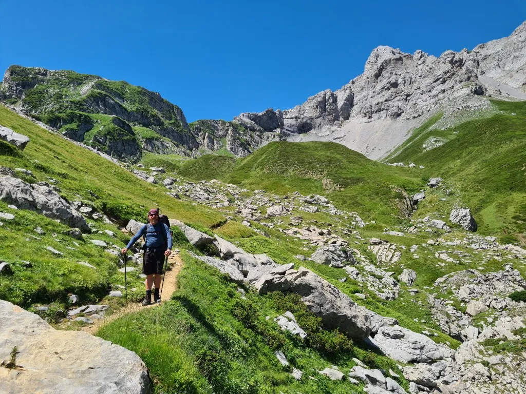
At the top of a slope stands a large chamois, overlooking its valley where we see four smaller chamois on large rocks. They too jump from stone to stone, descending along a large rock as if effortlessly. They are clearly made for this terrain. We have sturdy hiking boots and poles, and even then, it's much harder for us! But the tougher the journey, the more impressive the landscape becomes. We walk past large remnants of snow and ice and often have to climb vertically up or down the rocks. The stones are as rough as sandpaper; one misstep could lead to a nasty injury. The most intense part is the passage between Pic du Soum Couy and Pic d’Anie, just past Col d’Anie. The path between the peaks is strewn with loose rocks ranging from meters high to small pebbles. We make our way by balancing on the rocks. Suddenly, a large piece of stone breaks off, causing Mark to suddenly find himself a meter lower. He catches himself with his hand, which quickly turns blue, but thankfully it's not serious. We need to stay alert and look even more carefully. A bit further, there's a patch of snow, perfect for cooling his hand, which helps. The snow is so cold that the swelling doesn’t develop. One more vertical stretch to climb. Carefully, foot by foot from stone to stone, yet Malou's foot slips and she cuts her finger open. It bleeds quite a bit, but we need to find flat ground before we can tend to it. We clean the wound well and bandage it. Well, that wasn't the best kilometer we've had… But as long as it's just bumps and scratches, it's manageable. Not much further at the highest point, we find a large flat rock to rest and eat before we begin our descent. A moment to catch our breath at this magnificent place! Before us lies the stone field and Pic du Soum Couy, with Pic d’Anie behind us. In the distance, we can still see the green area where we slept last night. The paths behind us, which we'll soon descend, are slowly getting busier with hikers heading to the summit of Anie. A summit that is now very popular to conquer, but had never been visited before 1771. According to legend, there was a stunning garden with the fruits of immortality there, but the gods made it impossible to reach with hail and thunderstorms. Today, we're luckier with the weather; it's brilliantly sunny. After the break, the path improves, though we still need to search carefully at times, and again we navigate large rocks and deep abysses. We're relieved when we once again feel grass under our feet lower down, and it becomes more hiking than mountain climbing with a backpack. We continue to descend over narrow paths through grassland. We arrive at a shepherd's hut where signs indicate that cheese is sold. A hiker ahead of us tries his luck with the shepherd, but it's Monday, and nothing is sold. So, unfortunately, we too continue without cheese past cows, horses, and donkeys. And many hikers. Here, several trails converge, and we walk through a popular valley as the season slowly starts to peak. Further down, the grassland gives way to beech forests.
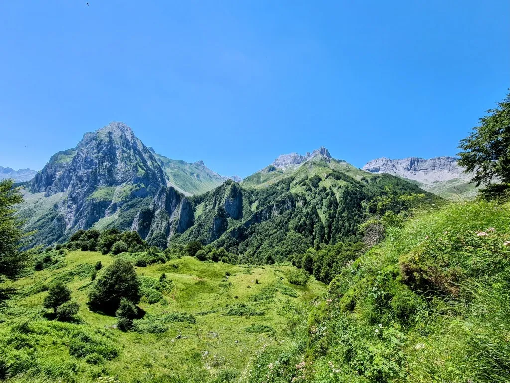
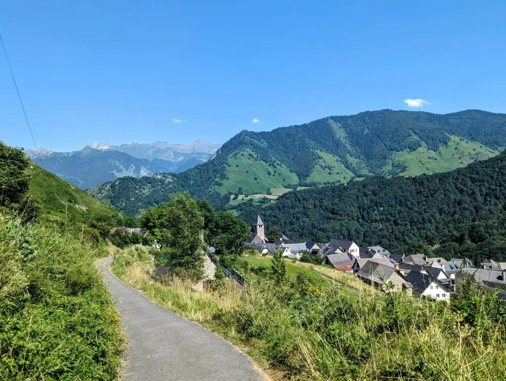
For kilometers, we descend through forest trails, often with stunning views of the mountains opposite us. After a while, we leave the woods and enter a more cultivated landscape of fields and meadows. Here is the parking lot where day hikers start. There's also an inn where we had hoped to take a break and have a drink, our water has been out for a while. Unfortunately, it doesn't open until four o'clock, and it's two o'clock when we arrive, but we do get water, so we can still take a break in a nearby meadow. It's extremely hot this far down the valley, so we quickly continue, heading further down towards the village. We follow a narrow road and then paths between fields and crops, with delicious wild strawberries along the way. We descend and descend into the mountain village of Lescun where, unexpectedly, a small grocery store is open, and we can get everything we need. The terraces are full of hikers. The cold drinks look tempting, but we prefer to head to the campground to set up our tent and settle in. It wasn't a long stage in kilometers, but the long sections over and through the rocks and the 1.850-meter descent have taken their toll today. What beautiful stages and what a magnificent mountain range! At the campground, we meet many hikers whom we had previously encountered at Refuge Belagua and at Iraty. Each has taken a different route, but we all end up at the same point. Time to relax at the campground. In two days, we'll continue further into the mountains.