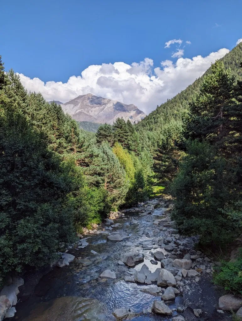
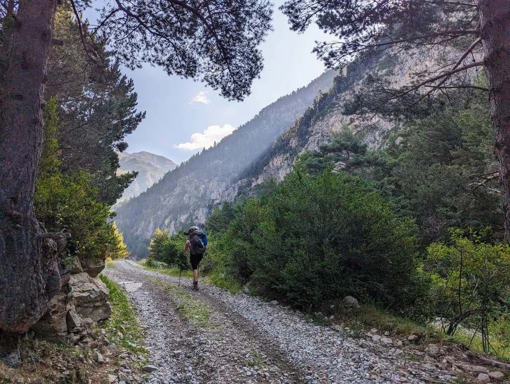
It's been 100 stages since we departed from that lighthouse in Portugal. From the ocean to the high mountains in the middle of the Pyrenees. Today we leave from the attic room, three floors up, in Parzán. We're well rested after a day off, thankfully, because we immediately descend three flights of stairs. We check out and hit the trail. The weather has cleared up again after the rain showers, and the sky is brilliantly blue. Due to the rising moisture in the air, the mountains gain more depth, the further away they are, the more vague the colors become. We walk the first one and a half kilometers along the main road towards France and then turn right onto a smaller road, into Valle de Bielsa. Past a few buildings, over a bridge across the Barrosa River, and then the road becomes unpaved. We walk among the trees, the valley is still well vegetated at this low point, but we start climbing right away. It's not very steep, but it's enough to work up a good sweat. And thirst. We've gone quite heavily laden because we won't encounter any shops for the next 6 stages, and we plan to stay a few days at the next campsite. To save weight, we've taken the minimum amount of water, but we did see a small spring on the map. Fortunately, it turns out to be flowing, although not very fast. The water is cold, so it comes from deep in the mountain, and with our Katadyn filter, we can purify it even more. We're not the only ones; another hiker is also eyeing some fresh water. You often come across people following more or less the same route, and these are great moments to strike up a conversation. He's a hiker from Israel doing a section of the HRP. It's nice to exchange hiking route tips; another beautiful route in Israel is added to our list ;-)
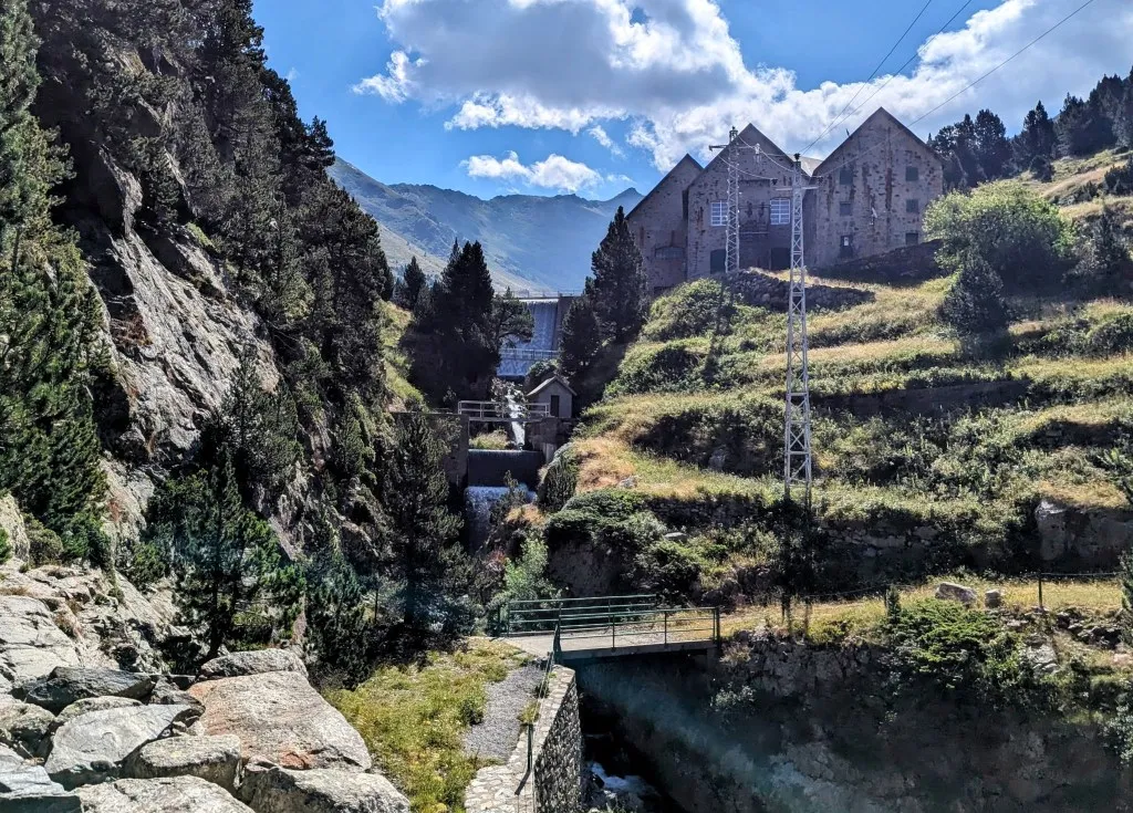
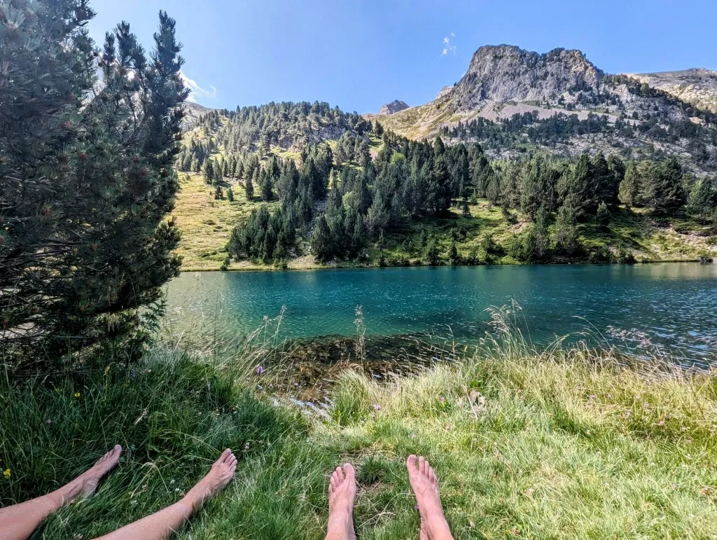
We continue walking with drinking water and water for coffee. The path is still wide; occasionally, a jeep passes by, but it's mainly busy with motorcycles heading towards a large lake higher up. One after another zooms past, but fortunately, they slow down when they see us. Nice. We quickly ascend, and slowly the landscape becomes more open. We see a large roof over a hill. At first, we think it's a refuge, but soon we spot a large concrete wall next to it with water streaming over it, and high-voltage cables coming out of the building. Electricity is generated by the reservoir next to it. It's a beautiful stone building, and the lake is even more beautiful. Gorgeous clear blue water surrounded by pine trees and grass. We've already walked 10 kilometers and climbed almost 800 meters; we're just past the halfway point of the hike, and this spot is too beautiful to pass up. We set up the chairs and enjoy one of the most beautiful rest spots we've had, although we say that quite often.
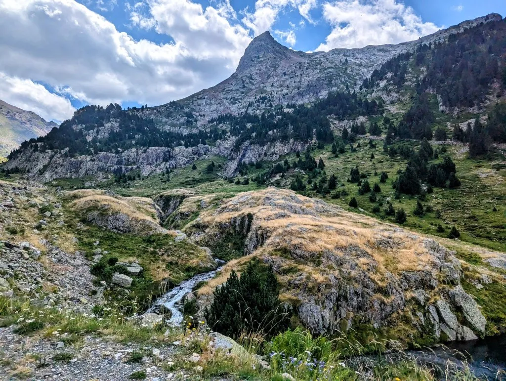
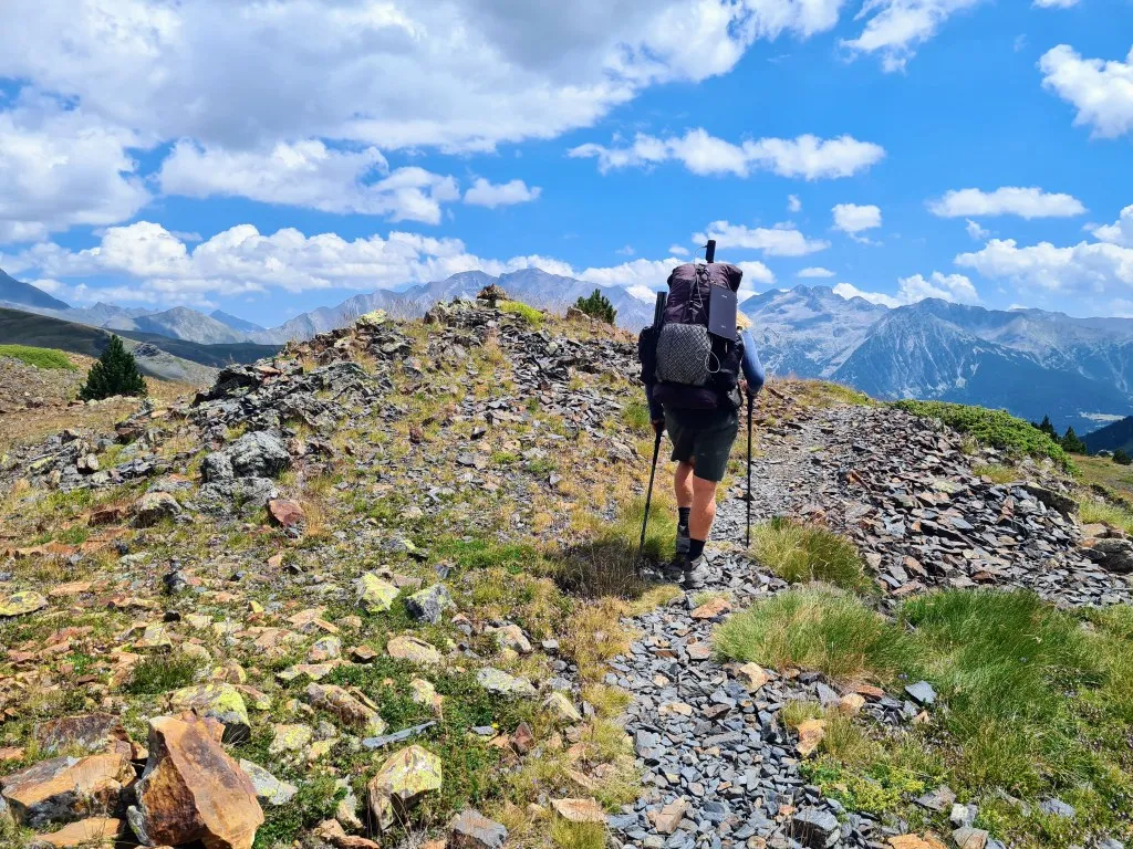
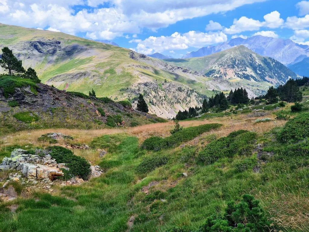
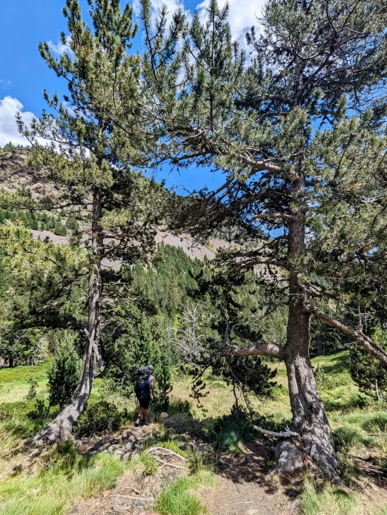
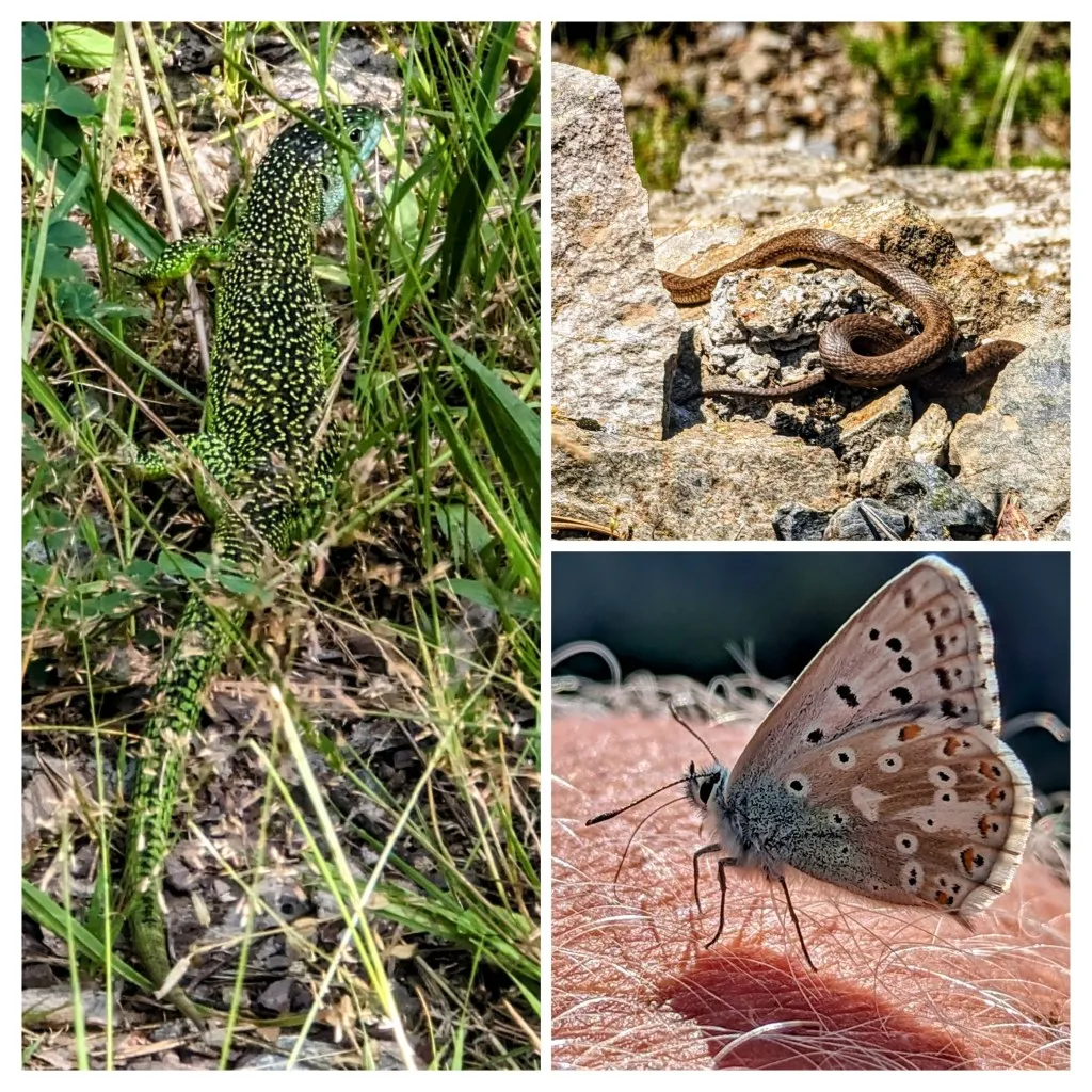
After the break, the slopes quickly become more open, and more and more we walk through grassland. Along the path, we see a snake curled up in the sun; when we take a step closer to get a better look, it quickly slithers under a rock. There's still about 350 meters to climb to reach the top. The last stretch is over rocks, but the col is green again. Col de Urdiceto at 2,311 meters is near the large reservoir Ibón de Urdiceto, but we don't see the lake; it's well hidden behind the hills. Here, in front of us, the descent begins. From the wide path, we enter the grasslands, a green valley. A little more climbing to the next small col and then it's really downhill. With a magnificent view of the mountains ahead of us, the highest parts of the Pyrenees where we'll walk through and over in the coming stages. What beautiful high mountains. Mainly bare mountains, but rocks in all colors. Peaks, points, and rounded tops. From this distance, you can see the layers of earth twisting and winding over the mountains. From the rocks, we go back to the grass, from the grass back to the pines, and a little later, we walk through a forest. In an open section, the ground becomes marshy; we walk through a swamp.
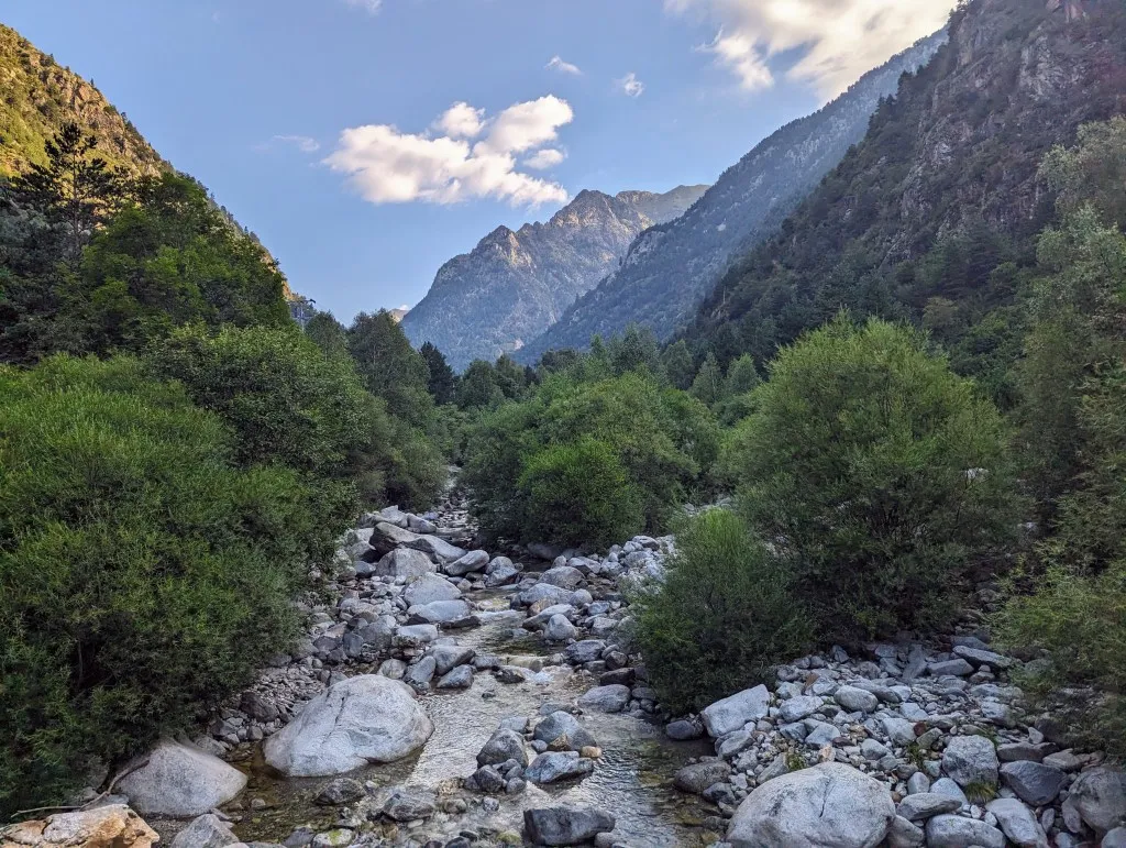
The ground and water are very iron-rich, and the water and stones are red-colored. Because of the marshy ground, the pine trees, and gray, dead trees in the water, it seems as if we've reached above the Arctic Circle. The climate at this altitude probably doesn't differ much. In an open area, far from the water because there were quite a few mosquitoes there, we take a second break overlooking the mountains. From here, the path widens again and winds downhill, but we can cut the corners more often by following smaller, steeper paths downhill. There are more butterflies and insects to see, and along the path, we see a large green emerald lizard scurry away. After about 20 kilometers, at the end of the descent, we reach a larger unpaved road in the valley of the Cinqueta River. It's clear that this road is driven on more frequently. We follow this road to camping El Forcallo, a very beautiful green terraced campsite by Spanish standards. Usually electricity, often hot water, but no phone reception or wifi. Even for us, it's a bit unusual, but actually quite refreshing and wonderfully peaceful. We have a nice spot for our tent, a good place to prepare for the next stages, heading towards the highest peaks of the Pyrenees.