This stage once again crosses the beautiful landscape of the Jura. The route descends to the village of Chapelle-des-Bois followed by a steep climb between cliffs. From here there is a magnificent view over the valley with Lac de Bellefontaine and Lac des Mortes. Due to a detour from the original route, the route does not remain flat from here, but descends again towards the lakes and goes via Bellefontaine and Hauts-de-Beinne to Les Rousses. The stage contains quite a bit of ascending and descending, but the scenery really makes up for it!
Wow, stage number 50 of the GR5! With the rest days and the 3 run-up stages, we are quite away from ‘home’ by now. How time flies… Every day we’re curious about what the day will bring and we are always hiking ‘somewhere’. So it doesn’t really feel like we’ve been walking for 12 weeks in a row, having spend our nights in 53 different places and being more than 1,200 kilometers away. We’re going strong!
We wake up early again at our spot in the woods. We don’t have much food left, but fortunately there is an epicerie not far from the start of the stage.
Around a quarter to 8 we head back to the trail. The first stretch descends through the forest. A little further on the landscape becomes more open and we see several young foxes running after each other through the freshly cut grass. Nice to see nature taking its course, undisturbed in the morning.
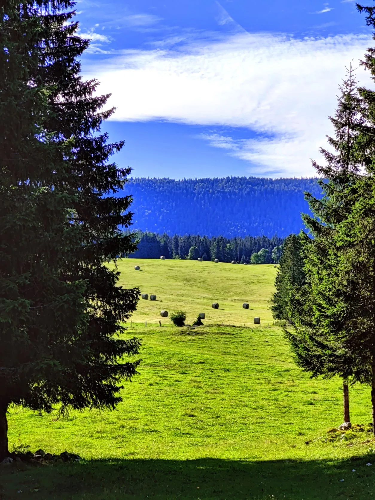
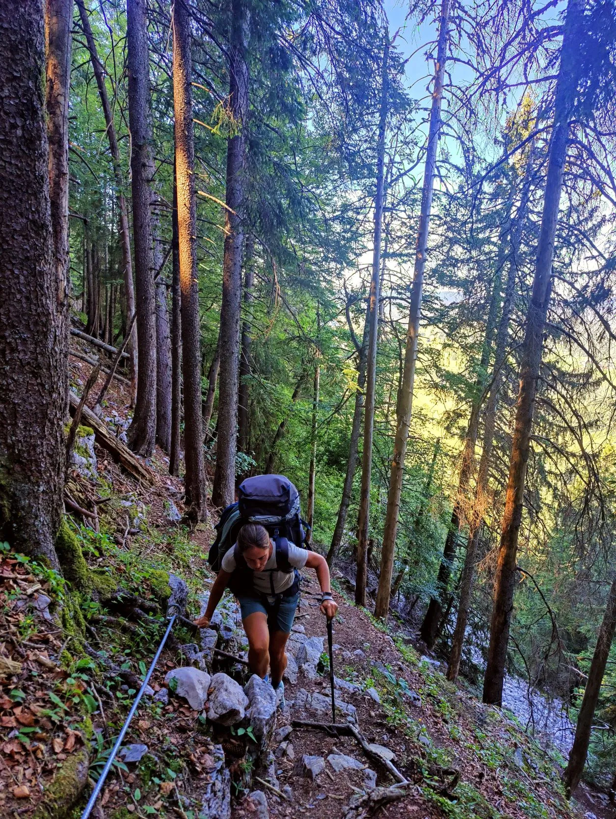
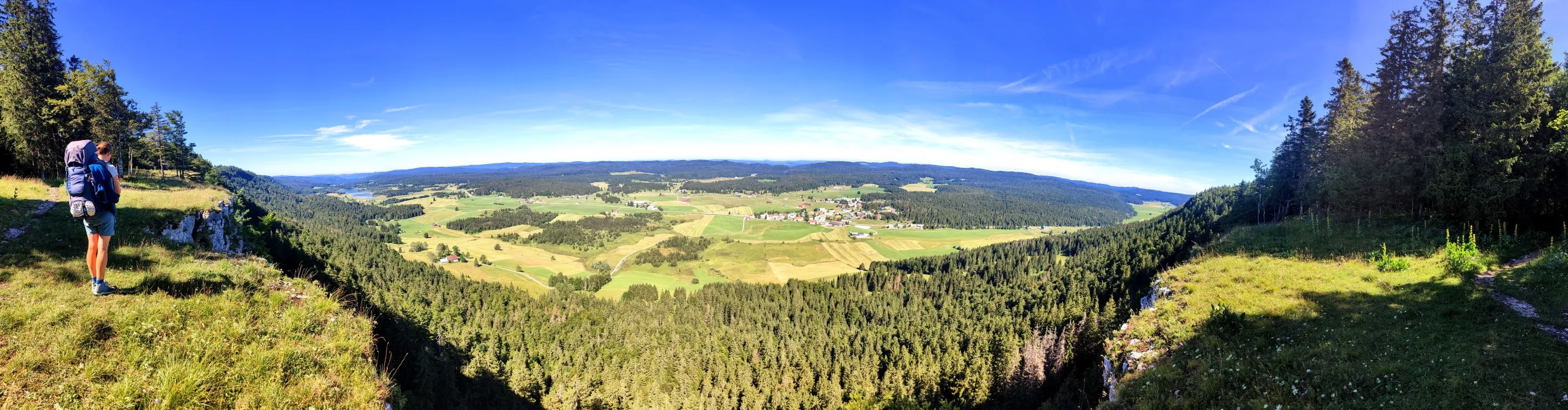
At the shop we do our shopping for the day and evening and walk through the flat landscape towards a steep slope with a cliff at the top. It looks imposing, and the trail goes up here somewhere. It can’t be but a steep climb. And that surely is; in 1.5 kilometers we go from 1,075m to 1,307m altitude. We haven’t had it this steep very often! Once on top, the route should remain fairly flat. Were it not for the fact that further along the route there is a detour sign… but before we encounter it, we first enjoy the magnificent view from atop this rock face. This is one of the best resting places we’ve ever had; a gorgeous view of a couple of small lakes in the valley below and of the Jura mountains we’ve been hiking through the last few days.
At the top we continue walking fairly flat until the navigation directs us to the left and the white and red signs point to the right. We look carefully at the map and see that a little further on there is another possibility to get to the original route and we decide to follow the new road. Even though it does lead us down the mountain again quite steeply….
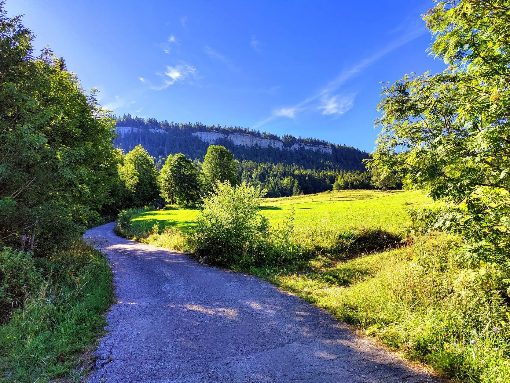
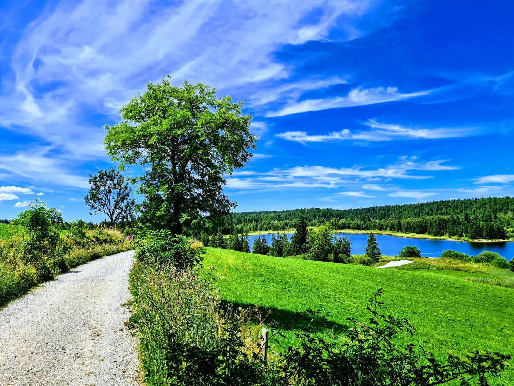
At the first side path where we expected to return to the old route, the route descends even further into the valley and finally we arrive back at the bottom, just a few kilometers from where we climbed up the steep cliff. Awww… we’ll have to go up again sooner or later. But the trail runs past the two lakes in the valley through beautiful scenery, so we have nothing to complain about right now and enjoy the beautiful path.
A little further on we see another road on the left going up, heading back to the old trail, but again the road markings send us in the opposite direction, even further down. In that case we would deviate even further from the original route. We decide to take off our backpacks, sit in the grass along the road for a while and consult Google Maps on what to do next. We stumble upon a Facebook post from some time ago, reporting that the route was rerouted at the time because of forest work. And apparently this detour has since become the official route. In any case, we now see that the new route leads through a few villages, a river valley and then with a good climb back to the original route, right before the place where we want to spend the night. We hope today’s 23-kilometer stage won’t be too much longer, because of the hot weather we’re already starting to run out of water.
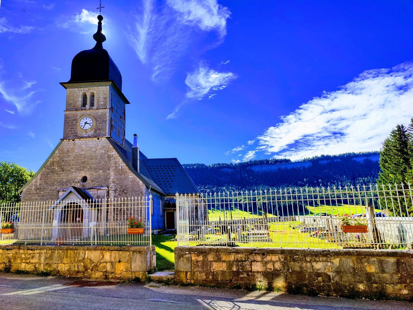
After this short break, we walk along the river valley through a few small French villages. At the beginning of the last climb, there is a house along the road where a couple of elderly people are sitting in the front yard under a sunscreen. A lady comes up to us and asks if we have enough to drink. Since our bottles are almost empty, she offers to fill a bottle with nice cool tap water. Wow, that’s really welcome on this hot day and with the final climb ahead of us.
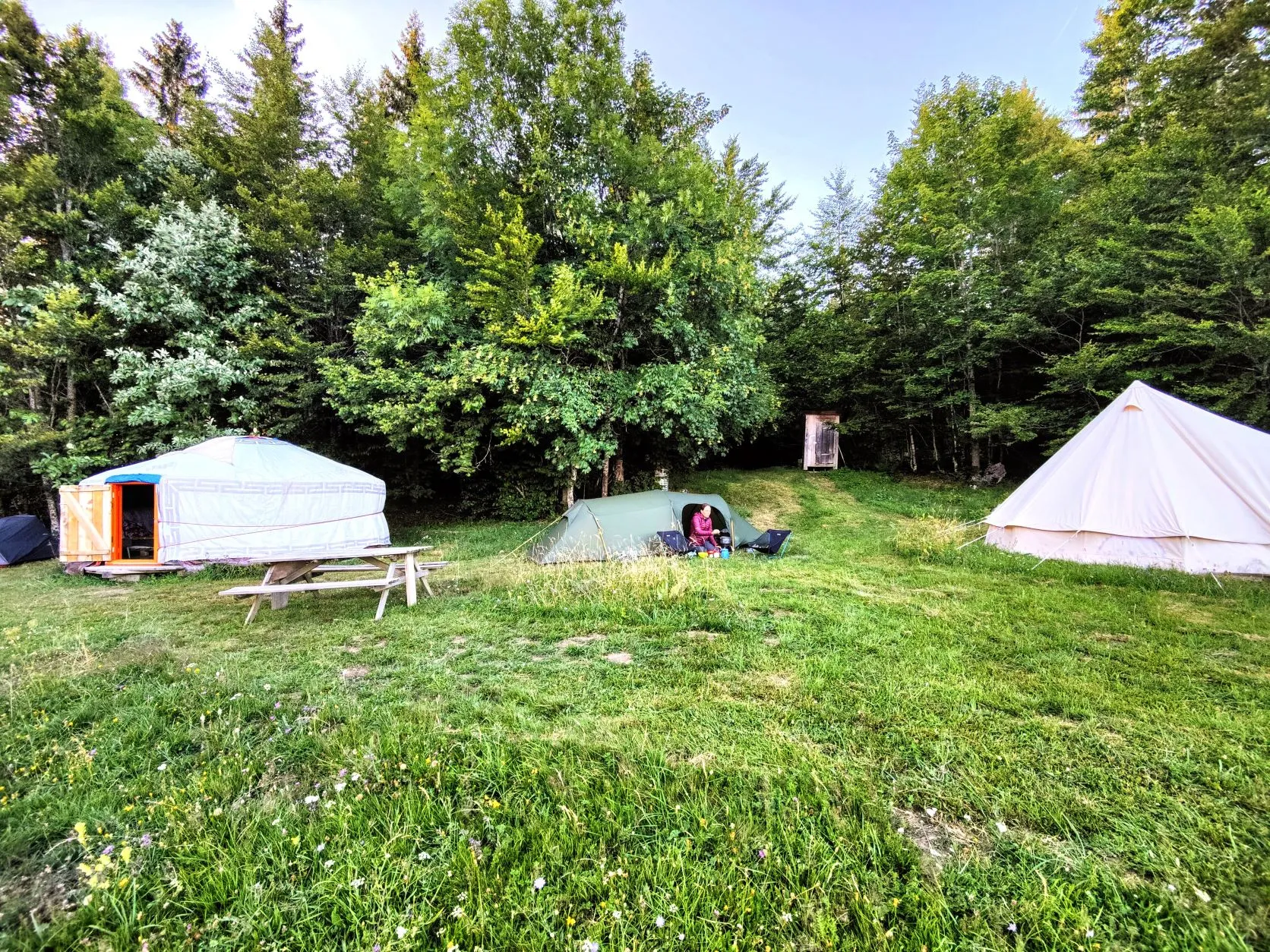
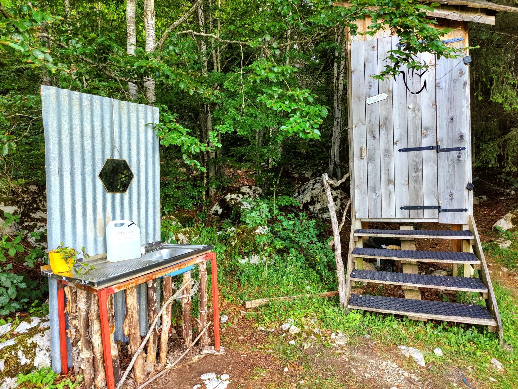
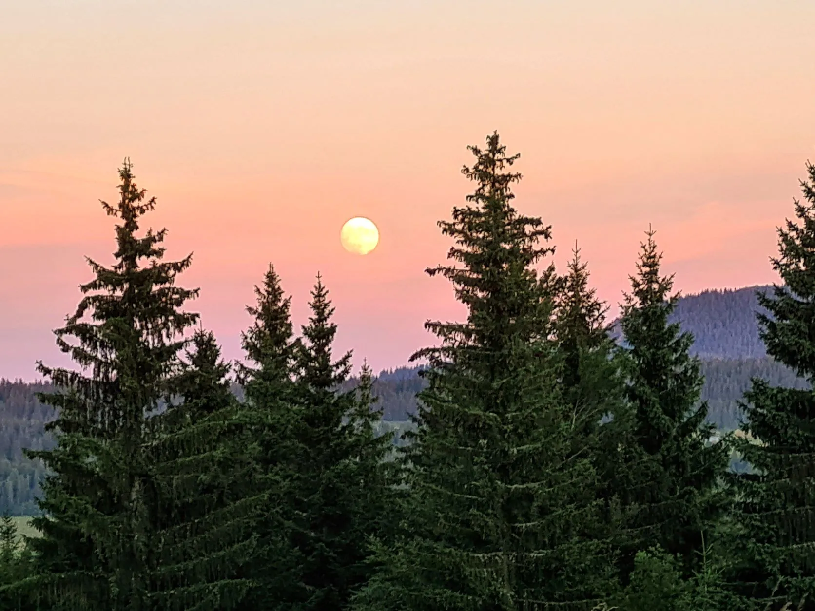
The route turns out to be a good 29 kilometers and it is already after 7 p.m. when we arrive at Lodge à Ponard. Truly a unique place! There is a yurt, a tipi and a restaurant on the edge of the forest at the top of a mountain. A travelling company with covered wagon and campers provides gypsy-style music at the restaurant tonight. It’s quite busy and there is a pleasant atmosphere. The facilities are primitive (the very welcome shower is made provosorically in the storage shed and the toilets are wooden sheds with a hole in the ground) but it’s a beautiful place and we enjoy our meal with live music, the setting sun and the full moon rising moments later from behind the mountains.
A lovely ending to a beautiful day 🌟
1 reactie