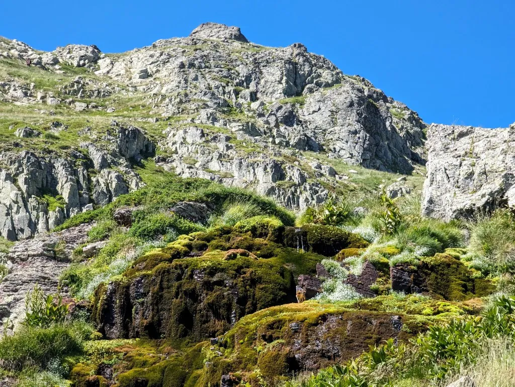
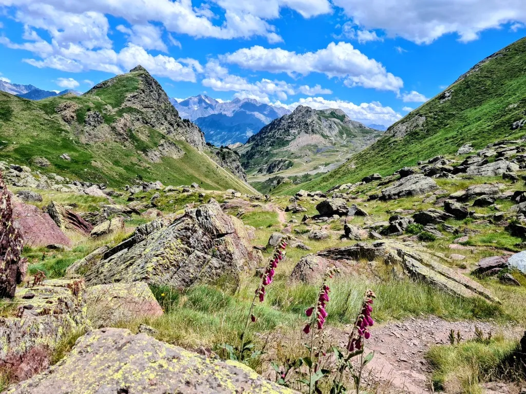
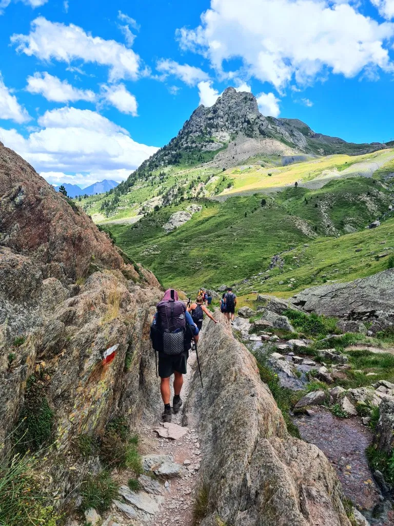
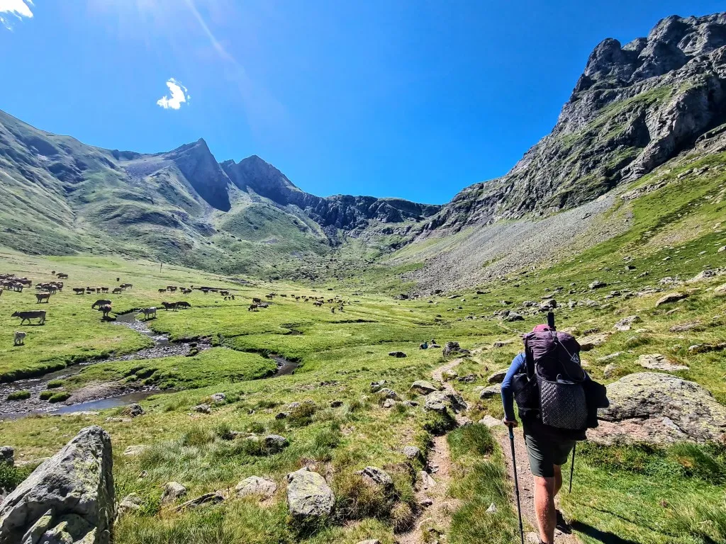
What luxury. Even in this hotel, we wake up to a beautiful view of the mountains. A few ski lifts and hotel resorts, but mostly forest, mountain, and rocks. Nowadays, Candanchu is primarily known for skiing and winter sports. It is one of the oldest ski resorts in Spain. Mountain hiking and biking are just a bonus. But in the past, this Spanish village was French and housed a military camp named 'Camp d’Anjou', which after becoming Spanish was corrupted into 'Candanchú'. There's also a Santiago route that passes through here, which we follow for a while out of the village. Here, larger and smaller roads cross the border with France, so the paths weave a bit between, over, and under the roads, but we quickly find ourselves amidst the greenery. We head towards the start of the long valley of the Rio Canal Roya. Here lies a large parking lot which, even though it's still early, is already completely full. From here, we follow a wide path that gradually ascends. We walk through forests and follow the river upstream. There are many hikers on the path, individuals, couples, and large groups. But the valley is so vast that we soon spread out a bit. Higher up, the landscape opens up and we reach the grasslands surrounded by high mountains. We continue to climb until we reach the end of the long valley at a high-altitude cirque, Círculos de Piedra. A large flat area surrounded by mountains on all sides, except where the river that originates here flows out of the mountains. Cows and horses graze here, high but sheltered by the mountains. We need to cross the rocks, but we don't see a path. After looking carefully, we spot a few dots climbing high up the slope. That's where we need to go.
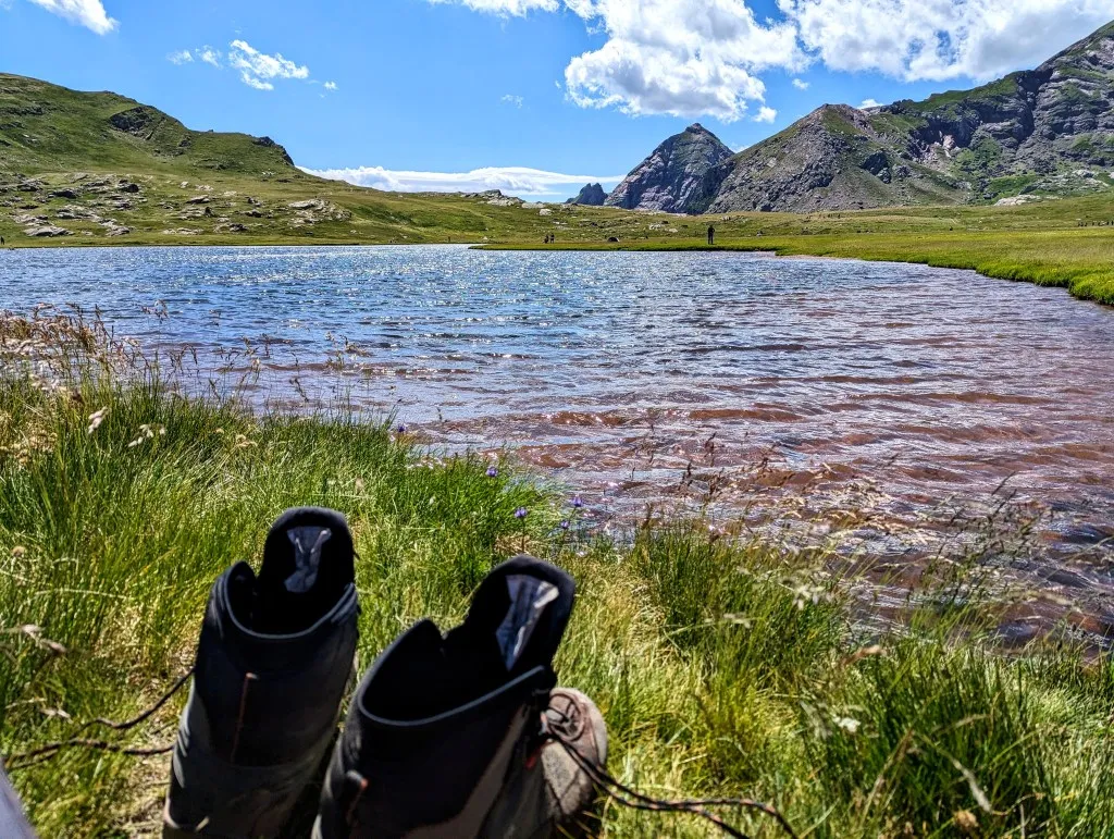
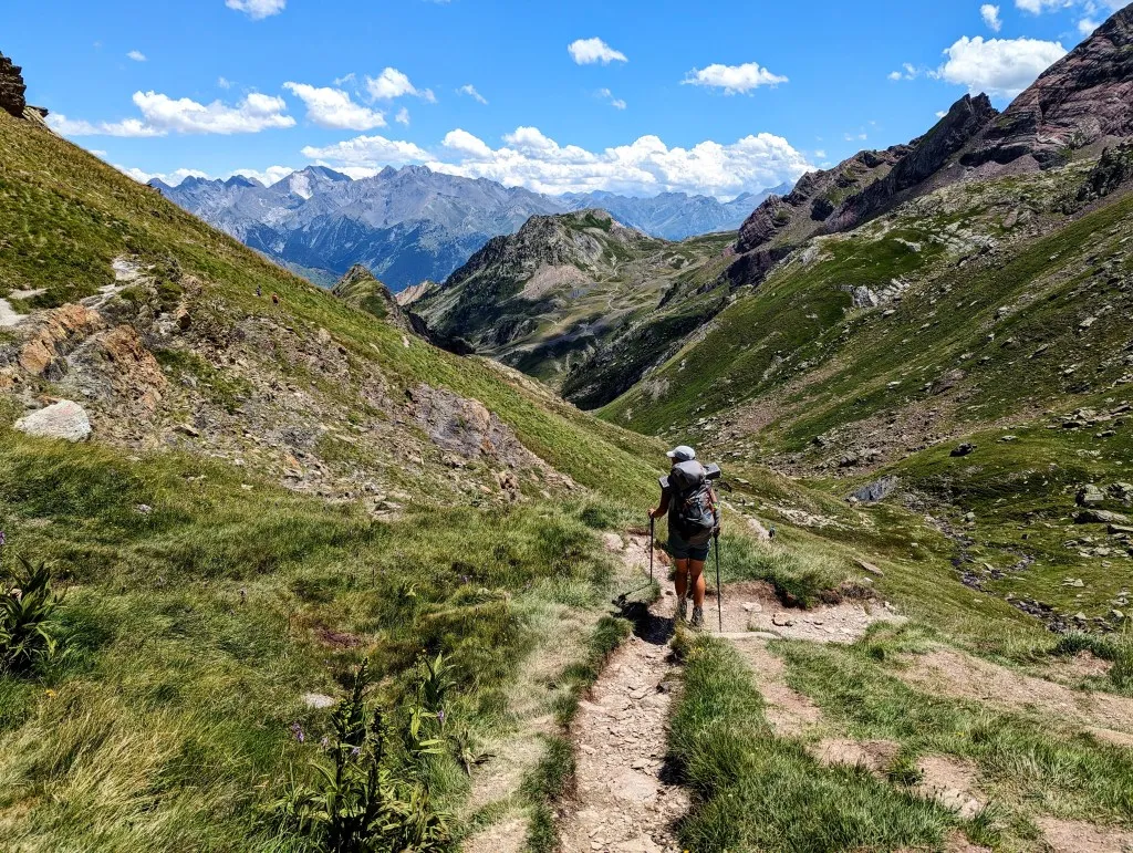
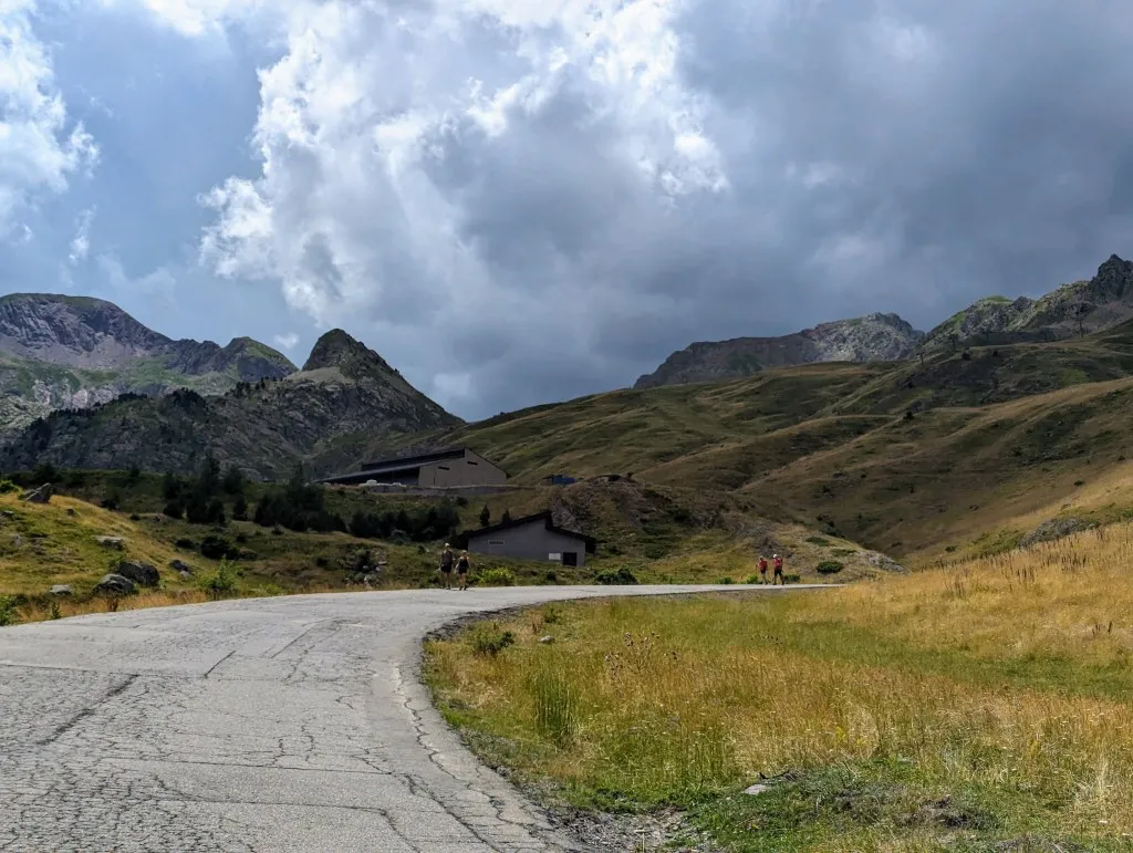
We cross the plain and begin the tough climb of 375 meters over 1.5 kilometers. Step by step, we climb. Fortunately, the path is generally good, better than it seemed from below, but it is steep! We take occasional drinks but wait to pause at the top, as there are lakes marked on the map there. During the climb, we enjoy stunning views of the valley, which grows further away, and admire the flowers and plants. It’s amazing to see how such small, fragile plants can survive among the rocks. It takes a while, but we reach the top. Here, the landscape is slightly hilly but mostly flat. The col is a large plain with several small and large lakes, Ibon de Anayet—glacial lakes at an altitude of 2,233 meters, with surrounding mountains well over 2,500 meters. In the water, there is a multitude of small creatures: fish, tadpoles, crayfish, and odd black worms about 10 centimeters long. Sheep and cows also dot the slopes. Because they appear so small, it emphasizes how far away they are grazing and the height of the slopes. The lakes are beautifully deep blue, and the grass and low shrubs around them are stunningly green. However, being on a col, it’s windy, almost stormy. We have to secure everything well and sit with our backs to the wind, but fortunately, it’s not cold and the sun is shining brightly. The climb up the last slope was quiet, but it’s busy here. Dozens of groups of people stand and sit around the lake. There are even a few tents scattered around. It’s very Instagram-worthy. It’s another break spot to enjoy for a long time, but we still have a significant distance to cover, and quite a bit of cloud is rolling in. After our sandwich, we pack up, enjoy the stunning lakes for a few more meters, and then start the descent on the other side of the valley. Initially, it’s quite steep, and the many people descending, and even more ascending towards the lakes, sometimes make it difficult to choose the right path. Hordes of people with tents are heading uphill. After 3 kilometers, we arrive at a ski complex, where the road becomes paved. We walk towards a main road from Spain to France over the Pyrenees, which we drove years ago when we were on vacation in the area. Back then, we had no idea we would ever reach here on foot from the southernmost and southwesternmost point of Europe. It’s nice to be walking here now! All the way down people with tents keep heading uphill. If everyone up by the lakes stays there, it will be a busy Saturday evening in the mountains! But the sky is starting to darken on that side. Hopefully, they have some extra tent pegs... Once at the road, we see the route crosses the road and goes back into the fields.
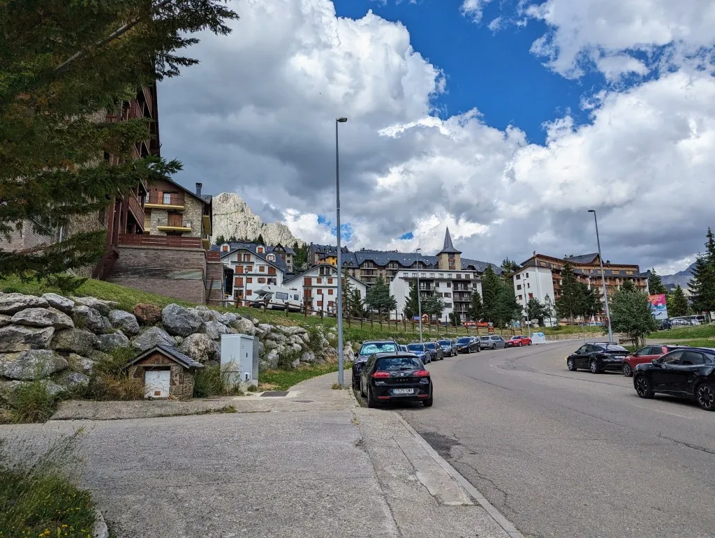
The GR11 that we’re now on continues to follow the road, but through the field. There are signs here and there, but the path is barely visible and very bumpy as if it were just cow paths. We’re starting to feel the kilometers and the elevation gains, so after a while, we decide to just walk along the road towards Formigal, the endpoint of today’s stage. It’s not the most exciting walk, but it’s nice to keep a good pace and not have to watch every step. Formigal is another ski village with plenty of slopes, hotels, and resorts. Although it’s larger and more lively than Candanchu, many hotels and shops are closed and will only open when there’s snow. The only hotel where we could still book a room is at the top of the village. We have a choice: follow a long winding road uphill, or take steel stairs built against the slope. We opt for the stairs, though there are many. We are glad to be at the top and are pleasantly surprised when we arrive at the hotel. It’s a chic resort, beautifully built with natural stone and wood. We have a lovely room with a view of the mountains we’re heading towards. There’s a fine restaurant and a good breakfast. Maybe book another night? Our legs surely could use a rest day… Well, we’ll sleep on it ;-)